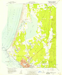
1956 Map of Crescent City
USGS Topo · Published 1957About this map
Crescent City and the rugged Del Norte coastline are captured here in the mid-1950s, a period when the local economy was anchored by the timber industry and maritime activity. The map illustrates a landscape of working timberlands, including several Lumber Mills and a Plywood Plant, nestled between the coastal Sand Dunes and the dense forests of Jedediah Smith Redwoods State Park. The street grid of the city is fully detailed, showing landmarks like the County Hospital and S S Emidio Memorial church.
Find a feature on this map
61 named features on this map. Tap any name to fly to it.
Don’t see what you’re looking for? This feature index may not catch every label — zoom into the map to look around manually.
Map Details
Editions of this 1956 Crescent City Map
2 editions found
Other maps of this area

1929 · Crescent City
USGS Topo · 1:125,000

1945 · Point St. George
USGS Topo · 1:62,500

1945 · Requa
USGS Topo · 1:62,500

1949 · Eureka
USGS Topo · 1:250,000
1952 · Klamath
USGS Topo · 1:62,500

1952 · Crescent City
USGS Topo · 1:62,500
1956 · Sister Rocks
USGS Topo · 1:24,000

1956 · Crescent City
USGS Topo · 1:24,000

1956 · Smith River
USGS Topo · 1:24,000

1958 · Eureka
USGS Topo · 1:250,000