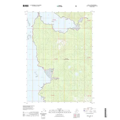
2021 Map of Sitka A-2 NW
USGS Topo · Published 2021About this map
Whitewater Bay and Wilson Cove define the jagged western coastline of Admiralty Island in this portion of the Tongass National Forest. The map documents a landscape where the sea meets steep elevations, anchored by the prominent Table Mtn rising above the interior. Small coastal landmarks and navigational hazards such as Lone Tree Islet, Healy Rock, and North Island are clearly delineated along the shorelines. From Point Caution in the north to Point Wilson in the south, the survey captures the complex topography of the Alexander Archipelago. This modern record provides precise coordinates for the numerous points and spits, including Black Point, Sand Point, Flag Point, and Rocky Point, which shape the maritime character of this largely roadless area.
Find a feature on this map
21 named features on this map. Tap any name to fly to it.
Don’t see what you’re looking for? This feature index may not catch every label — zoom into the map to look around manually.
Map Details
Editions of this 2021 Sitka A-2 NW Map
This is the sole edition of this map. No revisions or reprints were ever made.
Other maps of this area

1948 · Sitka B-3
USGS Topo · 1:63,360

1948 · Sitka A-3
USGS Topo · 1:63,360

1948 · Sitka A-2
USGS Topo · 1:63,360

1948 · Sitka B-2
USGS Topo · 1:63,360

1951 · Sitka
USGS Topo · 1:250,000

1951 · Sitka B-3
USGS Topo · 1:63,360

1951 · Sitka A-2
USGS Topo · 1:63,360
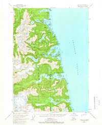
1951 · Sitka A-3
USGS Topo · 1:63,360

1951 · Sitka B-2
USGS Topo · 1:63,360

1952 · Sitka
USGS Topo · 1:250,000