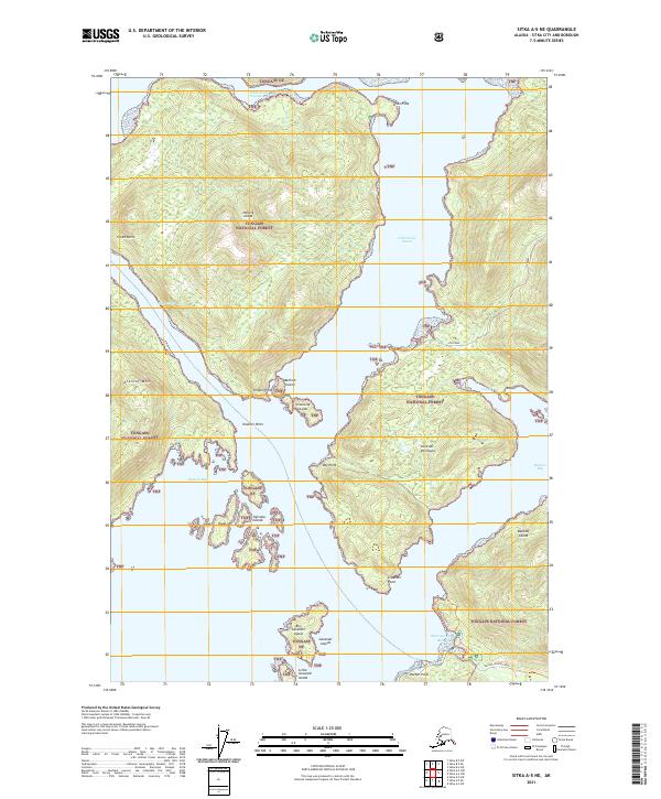
2021 Map of Sitka A-5 NE
USGS Topo · Published 2021About this map
Tongass National Forest dominates this coastal Alaska landscape, where the waters of Nakwasina Sound and Olga Strait carve out a complex network of islands and peninsulas north of Sitka. The geography is defined by significant landmasses like Halleck Island and the Lisianski Peninsula, separated by deep inlets such as Katlian Bay and Cedar Cove. To the south, the landscape transitions from the heights of Krestof Mtn toward the more accessible shoreline of Starrigavan Bay. Development is concentrated along the southern coast, where Halibut Point Road provides access to recreational paths like the Mosquito Cove Trl. This area illustrates the late twentieth and early twenty-first-century balance between industrial resource management, represented by the Nelson Logging Road, and the protected wilderness of the national forest system.
Find a feature on this map
37 named features on this map. Tap any name to fly to it.
Don’t see what you’re looking for? This feature index may not catch every label — zoom into the map to look around manually.
Map Details
Editions of this 2021 Sitka A-5 NE Map
This is the sole edition of this map. No revisions or reprints were ever made.
Other maps of this area

1948 · Sitka A-5
USGS Topo · 1:63,360

1948 · Sitka B-5
USGS Topo · 1:63,360

1951 · Sitka B-4
USGS Topo · 1:63,360

1951 · Sitka B-5
USGS Topo · 1:63,360

1951 · Sitka
USGS Topo · 1:250,000

1951 · Sitka A-4
USGS Topo · 1:63,360

1951 · Sitka A-5
USGS Topo · 1:63,360

1952 · Sitka
USGS Topo · 1:250,000

1954 · Sitka A-4
USGS Topo · 1:63,360

1964 · Sitka
USGS Topo · 1:250,000