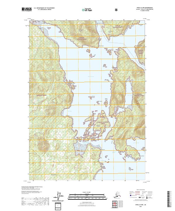
2021 Map of Sitka A-5 NW
USGS Topo · Published 2021About this map
Tongass National Forest encompasses the archipelago and rugged coastal terrain of this Sitka Sound region, where narrow waterways like Whitestone Narrows and Hayward Strait separate a cluster of major islands. The landscape is defined by its maritime geology, featuring prominent peaks such as Krestof Mtn on Krestof Island and the distinctive volcanic profile of The Cone on Kruzof Island. These landmasses are connected by a network of specialized routes, including the Lower Cone Road Trl and Iris Meadows Road Trl, which navigate the interior forests and coastal flats of Iris Meadows. The intricate shoreline is dotted with numerous small landforms such as the Magoun Islands and Brady Island, illustrating the complex coastal navigation required in the Krestof Sound and Neva Strait corridors. The distribution of these features reveals a wilderness shaped by its proximity to the sea and the legacy of early-21st-century forest management.
Find a feature on this map
46 named features on this map. Tap any name to fly to it.
Don’t see what you’re looking for? This feature index may not catch every label — zoom into the map to look around manually.
Map Details
Editions of this 2021 Sitka A-5 NW Map
This is the sole edition of this map. No revisions or reprints were ever made.
Other maps of this area

1948 · Sitka A-5
USGS Topo · 1:63,360

1948 · Sitka B-5
USGS Topo · 1:63,360

1951 · Sitka A-6
USGS Topo · 1:63,360

1951 · Sitka B-6
USGS Topo · 1:63,360

1951 · Sitka B-5
USGS Topo · 1:63,360

1951 · Sitka
USGS Topo · 1:250,000

1951 · Sitka A-5
USGS Topo · 1:63,360

1952 · Sitka
USGS Topo · 1:250,000

1964 · Sitka
USGS Topo · 1:250,000
1987 · Sitka A-5 SE
USGS Topo · 1:25,000