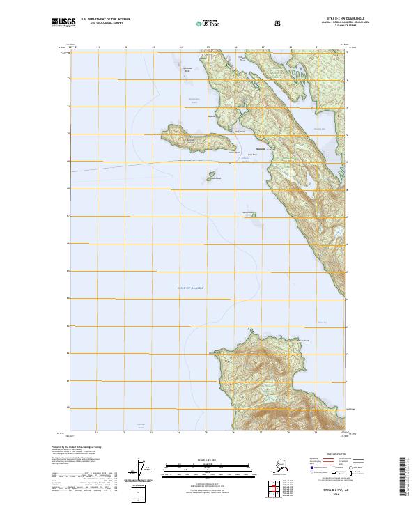
2024 Map of Sitka B-2 NW
USGS Topo · Published 2024About this map
Angoon stands as the primary settlement on this stretch of the western coast of Admiralty Island, positioned near the strategic waters of Kootznahoo Roads. The map highlights the town's administrative role through the Angoon Courthouse, while the surrounding geography is defined by a complex network of inlets and islands. To the south, Killisnoo Harbor and Killisnoo Island provide sheltered passage from the open Gulf of Alaska and Chatham Strait. Much of the territory falls under the protection of the Tongass National Forest and the Admiralty Island National Monument, with the Kootznoowoo Wilderness preserving the interior's character. Significant coastal landmarks like Saginaw Point and Point Samuel frame the narrow waterways that have long supported the region's maritime way of life.
Find a feature on this map
30 named features on this map. Tap any name to fly to it.
Don’t see what you’re looking for? This feature index may not catch every label — zoom into the map to look around manually.
Map Details
Editions of this 2024 Sitka B-2 NW Map
This is the sole edition of this map. No revisions or reprints were ever made.
Other maps of this area

1948 · Sitka B-3
USGS Topo · 1:63,360

1948 · Sitka C-2
USGS Topo · 1:63,360

1948 · Sitka C-3
USGS Topo · 1:63,360

1948 · Sitka B-2
USGS Topo · 1:63,360

1951 · Sitka
USGS Topo · 1:250,000

1951 · Sitka B-3
USGS Topo · 1:63,360

1951 · Sitka B-2
USGS Topo · 1:63,360

1951 · Sitka C-3
USGS Topo · 1:63,360

1951 · Sitka C-2
USGS Topo · 1:63,360

1952 · Sitka
USGS Topo · 1:250,000