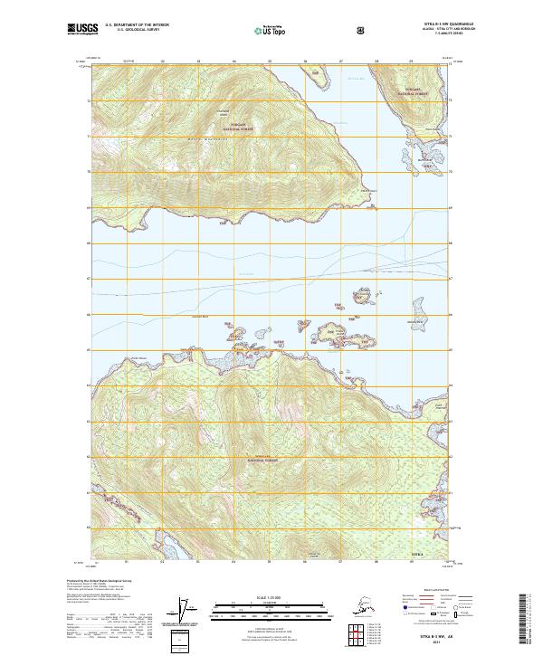
2021 Map of Sitka B-3 NW
USGS Topo · Published 2021About this map
Tongass National Forest dominates this landscape, spanning the maritime pass where Chichagof Island and Catherine Island converge. The topography is defined by the steep rises of the Moore Mountains and a complex coastline punctuated by natural harbors such as Sitkoh Bay and Florence Bay. Human activity is concentrated along the shorelines, as evidenced by the presence of Sitkoh Cannery and Sitkoh Todd, sites that reflect the region's enduring ties to the commercial fishing and canning industries. These settlements and industrial landmarks are connected by several forest routes, including the Portage Arm East and the Catherine Island Whale C track. Navigational landmarks like Point Craven and Point Thatcher frame the entrance to the narrow Thatcher Channel, providing critical points of reference for travel through the busy waters of Peril Strait.
Find a feature on this map
27 named features on this map. Tap any name to fly to it.
Don’t see what you’re looking for? This feature index may not catch every label — zoom into the map to look around manually.
Map Details
Editions of this 2021 Sitka B-3 NW Map
This is the sole edition of this map. No revisions or reprints were ever made.
Other maps of this area

1948 · Sitka B-3
USGS Topo · 1:63,360

1948 · Sitka C-3
USGS Topo · 1:63,360

1951 · Sitka B-4
USGS Topo · 1:63,360

1951 · Sitka C-4
USGS Topo · 1:63,360

1951 · Sitka
USGS Topo · 1:250,000

1951 · Sitka B-3
USGS Topo · 1:63,360

1951 · Sitka C-3
USGS Topo · 1:63,360

1952 · Sitka
USGS Topo · 1:250,000

1964 · Sitka
USGS Topo · 1:250,000
1997 · Sitka C-3
USGS Topo · 1:63,360