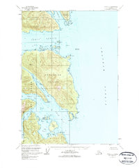
1951 Map of Sitka B-3
USGS Topo · Published 1963About this map
Catherine Island dominates the center of this maritime landscape, surrounded by the intricate waterways of Southeast Alaska. This mid-century survey, based on 1948 aerial photography, details a complex network of channels and inlets including Peril Strait and Chatham Strait. The shoreline is marked by early-stage coastal development, indicated by scattered Cabins near Fairway I and a Cabin on Crow Island.
Find a feature on this map
43 named features on this map. Tap any name to fly to it.
Don’t see what you’re looking for? This feature index may not catch every label — zoom into the map to look around manually.
Map Details
Editions of this 1951 Sitka B-3 Map
2 editions found

Other maps of this area

1948 · Sitka B-3
USGS Topo · 1:63,360

1948 · Sitka A-3
USGS Topo · 1:63,360

1948 · Sitka C-2
USGS Topo · 1:63,360

1948 · Sitka A-2
USGS Topo · 1:63,360

1948 · Sitka C-3
USGS Topo · 1:63,360

1948 · Sitka B-2
USGS Topo · 1:63,360

1951 · Sitka B-4
USGS Topo · 1:63,360

1951 · Sitka C-4
USGS Topo · 1:63,360

1951 · Sitka
USGS Topo · 1:250,000

1951 · Sitka A-4
USGS Topo · 1:63,360