
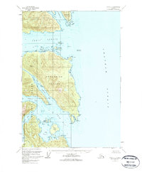
1951 Map of Sitka B-3
USGS Topo · Published 1963About this map
Catherine Island dominates this 1951 topographic study, situated at the complex intersection of several major Alaskan waterways. The map illustrates the convergence of Peril Strait and Chatham Strait, providing a detailed look at the maritime geography of the Alexander Archipelago. To the north, the coastline of Chichagof Island is defined by Sitkoh Bay and Florence Bay, while the southern reaches of the map show the northern tip of Baranof Island separated by the finger-like inlets of Middle Arm and South Arm.
Find a feature on this map
34 named features on this map. Tap any name to fly to it.
Don’t see what you’re looking for? This feature index may not catch every label — zoom into the map to look around manually.
Map Details
Editions of this 1951 Sitka B-3 Map
2 editions found
Other maps of this area

1948 · Sitka B-3
USGS Topo · 1:63,360

1948 · Sitka A-3
USGS Topo · 1:63,360

1948 · Sitka C-2
USGS Topo · 1:63,360

1948 · Sitka A-2
USGS Topo · 1:63,360

1948 · Sitka C-3
USGS Topo · 1:63,360

1948 · Sitka B-2
USGS Topo · 1:63,360

1951 · Sitka B-4
USGS Topo · 1:63,360

1951 · Sitka C-4
USGS Topo · 1:63,360

1951 · Sitka
USGS Topo · 1:250,000

1951 · Sitka A-4
USGS Topo · 1:63,360