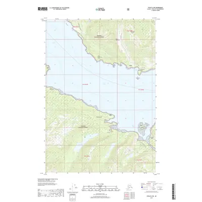
2017 Map of Sitka B-4 NE
USGS Topo · Published 2017About this map
Todd stands on the eastern shore of Chichagof Island, overlooking the waters where Peril Strait meets Lindenberg Harbor. This coastal landscape within the Tongass National Forest is defined by the narrow waterways separating major landmasses, including Baranof Island to the south and Catherine Island to the southeast. The geography of the region dictates movement via maritime routes and a few specialized forest tracks like the Sitkoh Lake Spur Road and the Catherine Island Whale route.
Find a feature on this map
31 named features on this map. Tap any name to fly to it.
Don’t see what you’re looking for? This feature index may not catch every label — zoom into the map to look around manually.
Map Details
Editions of this 2017 Sitka B-4 NE Map
This is the sole edition of this map. No revisions or reprints were ever made.
Other maps of this area

1948 · Sitka B-3
USGS Topo · 1:63,360

1948 · Sitka C-3
USGS Topo · 1:63,360

1951 · Sitka B-4
USGS Topo · 1:63,360

1951 · Sitka C-4
USGS Topo · 1:63,360

1951 · Sitka
USGS Topo · 1:250,000

1951 · Sitka B-3
USGS Topo · 1:63,360

1951 · Sitka C-3
USGS Topo · 1:63,360

1952 · Sitka
USGS Topo · 1:250,000

1964 · Sitka
USGS Topo · 1:250,000
1997 · Sitka C-3
USGS Topo · 1:63,360