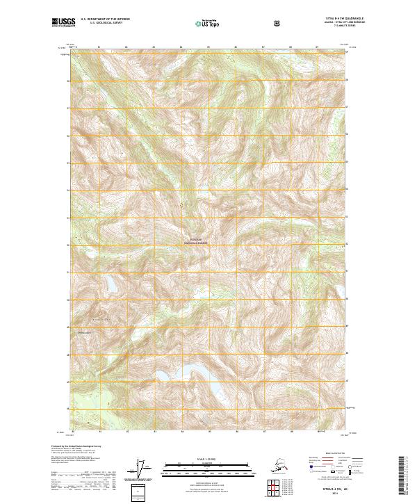
2021 Map of Sitka B-4 SW
USGS Topo · Published 2021About this map
Tongass National Forest dominates this Alaskan landscape, where steep topography defines the drainage patterns of the coastal mountains. The northern half of the sheet is marked by the valley of Rodman Cr, while the southern reaches are shaped by the high peaks of Annahootz Mtn and Mt Rosenberg. These summits overlook the headwaters of Fish Bay Cr, illustrating the typical glacial-cut terrain of the region. The map preserves the legal framework of the area through established survey boundaries, including t53s r63e and t52s r64e, which overlay the wilderness and dictate land management within the national forest system.
Find a feature on this map
9 named features on this map. Tap any name to fly to it.
Don’t see what you’re looking for? This feature index may not catch every label — zoom into the map to look around manually.
Map Details
Editions of this 2021 Sitka B-4 SW Map
This is the sole edition of this map. No revisions or reprints were ever made.
Other maps of this area

1948 · Sitka A-5
USGS Topo · 1:63,360

1948 · Sitka B-5
USGS Topo · 1:63,360

1951 · Sitka B-4
USGS Topo · 1:63,360

1951 · Sitka B-5
USGS Topo · 1:63,360

1951 · Sitka
USGS Topo · 1:250,000

1951 · Sitka A-4
USGS Topo · 1:63,360

1951 · Sitka A-5
USGS Topo · 1:63,360

1952 · Sitka
USGS Topo · 1:250,000

1954 · Sitka A-4
USGS Topo · 1:63,360

1964 · Sitka
USGS Topo · 1:250,000