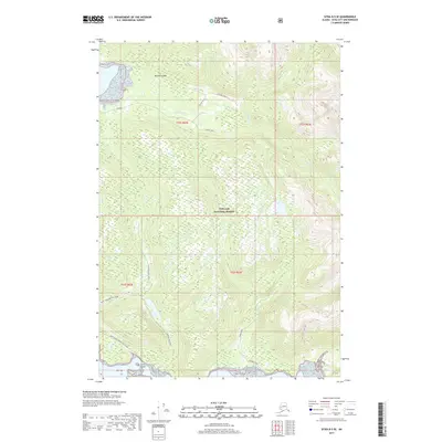
2017 Map of Sitka B-5 SE
USGS Topo · Published 2017About this map
Baranof Island serves as the backdrop for this coastal topographical study, primarily encompassing the dense terrain of the Tongass National Forest. The landscape is defined by its dramatic drainage systems, notably Fish Bay Cr flowing into Fish Bay in the north, and Noxon Creek winding toward the southern shoreline near Limit Island. This 2017 edition documents a network of forest access routes including the Fish Bay Spur 1, Fish Bay Spur 2, and Fish Bay Spur 3. Along the southwestern coast, the map traces specific infrastructure like Saint John the Baptist Road and the Limit Island Road, reflecting the specialized land use and transportation patterns within this remote section of Southeast Alaska.
Find a feature on this map
17 named features on this map. Tap any name to fly to it.
Don’t see what you’re looking for? This feature index may not catch every label — zoom into the map to look around manually.
Map Details
Editions of this 2017 Sitka B-5 SE Map
This is the sole edition of this map. No revisions or reprints were ever made.
Other maps of this area

1948 · Sitka A-5
USGS Topo · 1:63,360

1948 · Sitka B-5
USGS Topo · 1:63,360

1951 · Sitka B-4
USGS Topo · 1:63,360

1951 · Sitka B-5
USGS Topo · 1:63,360

1951 · Sitka
USGS Topo · 1:250,000

1951 · Sitka A-4
USGS Topo · 1:63,360

1951 · Sitka A-5
USGS Topo · 1:63,360

1952 · Sitka
USGS Topo · 1:250,000

1954 · Sitka A-4
USGS Topo · 1:63,360

1964 · Sitka
USGS Topo · 1:250,000