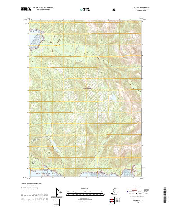
2021 Map of Sitka B-5 SE
USGS Topo · Published 2021About this map
Saint John The Baptist sits along the western shoreline of this coastal Alaskan landscape, where the waters of Fish Bay meet the heavily forested slopes of the Tongass National Forest. The map detail reveals a specialized network of forest access routes, including Fish Bay Spur 1, Fish Bay Spur 2, and Fish Bay Spur 3, which penetrate the interior timberlands north of Fish Bay Cr. To the south, the terrain becomes increasingly complex as it approaches the Nakwasina Passage and the Gulf of Alaska, marked by a series of specialized trails. These routes, such as the Saint-John Baptist Road Trl and the C And B Lake Road Trl, illustrate the modern infrastructure required to navigate this remote maritime environment. The presence of Limit Island and its namesake Limit Island Road Trl highlights the intersection of coastal navigation and inland transport in this borough.
Find a feature on this map
20 named features on this map. Tap any name to fly to it.
Don’t see what you’re looking for? This feature index may not catch every label — zoom into the map to look around manually.
Map Details
Editions of this 2021 Sitka B-5 SE Map
This is the sole edition of this map. No revisions or reprints were ever made.
Other maps of this area

1948 · Sitka A-5
USGS Topo · 1:63,360

1948 · Sitka B-5
USGS Topo · 1:63,360

1951 · Sitka B-4
USGS Topo · 1:63,360

1951 · Sitka B-5
USGS Topo · 1:63,360

1951 · Sitka
USGS Topo · 1:250,000

1951 · Sitka A-4
USGS Topo · 1:63,360

1951 · Sitka A-5
USGS Topo · 1:63,360

1952 · Sitka
USGS Topo · 1:250,000

1954 · Sitka A-4
USGS Topo · 1:63,360

1964 · Sitka
USGS Topo · 1:250,000