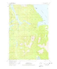
1951 Map of Sitka C-1
USGS Topo · Published 1978About this map
Admiralty Island dominates this mid-century survey, revealing a landscape of interconnected waterways and isolated outposts within the Tongass National Forest. The map documents a sparsely settled interior where life centered around the massive Hasselborg Lake and the coastal waters of the Seymour Canal. Notable human imprints include the Hasselborg Homestead near Mole Harbor and Camp Shaheen to the north, reflecting an era of early homesteading and wilderness recreation.
Find a feature on this map
36 named features on this map. Tap any name to fly to it.
Don’t see what you’re looking for? This feature index may not catch every label — zoom into the map to look around manually.
Map Details
Editions of this 1951 Sitka C-1 Map
3 editions found

Other maps of this area

1948 · Sitka D-1
USGS Topo · 1:63,360

1948 · Sitka B-1
USGS Topo · 1:63,360

1948 · Sitka C-2
USGS Topo · 1:63,360

1948 · Sitka D-2
USGS Topo · 1:63,360

1948 · Sitka C-1
USGS Topo · 1:63,360

1948 · Sumdum D-6
USGS Topo · 1:63,360

1948 · Sumdum B-6
USGS Topo · 1:63,360

1948 · Sumdum C-6
USGS Topo · 1:63,360

1948 · Sitka B-2
USGS Topo · 1:63,360

1951 · Sitka
USGS Topo · 1:250,000