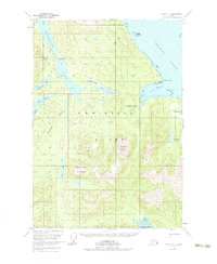
1951 Map of Sitka C-1
USGS Topo · Published 1983About this map
Admiralty Island's intricate network of freshwater lakes and coastal inlets is documented here during a 1951 field annotation. The interior is dominated by Hasselborg Lake, which serves as a central hub for the surrounding wilderness, connected to smaller bodies of water like Lake Alexander and Beaver Lake. Evidence of early 20th-century habitation and seasonal use is found at the Hasselborg Homestead near the mouth of the River and Camp Shaheen on the northern lake shore.
Find a feature on this map
31 named features on this map. Tap any name to fly to it.
Don’t see what you’re looking for? This feature index may not catch every label — zoom into the map to look around manually.
Map Details
Editions of this 1951 Sitka C-1 Map
3 editions found

Other maps of this area

1948 · Sitka D-1
USGS Topo · 1:63,360

1948 · Sitka B-1
USGS Topo · 1:63,360

1948 · Sitka C-2
USGS Topo · 1:63,360

1948 · Sitka D-2
USGS Topo · 1:63,360

1948 · Sitka C-1
USGS Topo · 1:63,360

1948 · Sumdum D-6
USGS Topo · 1:63,360

1948 · Sumdum B-6
USGS Topo · 1:63,360

1948 · Sumdum C-6
USGS Topo · 1:63,360

1948 · Sitka B-2
USGS Topo · 1:63,360

1951 · Sitka
USGS Topo · 1:250,000