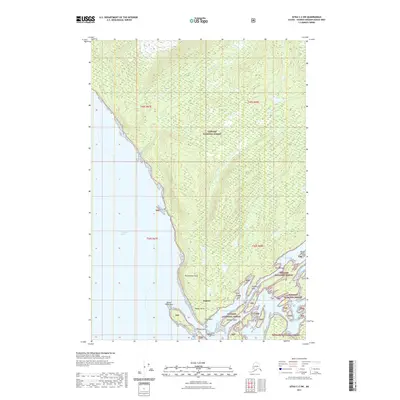
2021 Map of Sitka C-2 SW
USGS Topo · Published 2021About this map
Angoon sits at the southwestern edge of Admiralty Island, positioned between the waters of Chatham Strait and the intricate coastal landscape of Kootznahoo Inlet. This 2021 survey details the complex marine geography of the area, featuring points and reefs such as Danger Point, Danger Point Reef, and Kootznahoo Head. The map illustrates the coastal navigation routes near Stillwater Anchorage and False Channel, as well as named maritime landmarks like Village Rock and Rose Rock. Inland, the terrain is dominated by the Tongass National Forest, with significant water bodies like Thayer Cr flowing through the timberlands. Notable local sites include Hollis Acre and the Point Bridge, providing a modern look at the settlement's infrastructure and its relationship with the surrounding wilderness of Southeast Alaska.
Find a feature on this map
23 named features on this map. Tap any name to fly to it.
Don’t see what you’re looking for? This feature index may not catch every label — zoom into the map to look around manually.
Map Details
Editions of this 2021 Sitka C-2 SW Map
This is the sole edition of this map. No revisions or reprints were ever made.
Other maps of this area

1948 · Sitka B-3
USGS Topo · 1:63,360

1948 · Sitka C-2
USGS Topo · 1:63,360

1948 · Sitka C-3
USGS Topo · 1:63,360

1948 · Sitka B-2
USGS Topo · 1:63,360

1951 · Sitka
USGS Topo · 1:250,000

1951 · Sitka B-3
USGS Topo · 1:63,360

1951 · Sitka B-2
USGS Topo · 1:63,360

1951 · Sitka C-3
USGS Topo · 1:63,360

1951 · Sitka C-2
USGS Topo · 1:63,360

1952 · Sitka
USGS Topo · 1:250,000