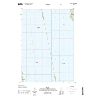
2017 Map of Sitka C-3 SE
USGS Topo · Published 2017About this map
Tongass National Forest covers the small fragments of land that border the expansive waters of the Pacific Ocean and the Gulf of Alaska in this coastal Alaskan survey. The maritime character of the region is defined by the intersection of open ocean and the sheltered passage of Chatham Strait. Geographically, the area is split by the administrative boundary of the Hoonah-Angoon Census Area and Sitka Borough. The few terrestrial landmarks, such as Parker Point in the northeast and Peninsular Point in the southwest, serve as essential navigational markers for the rugged coastline. The map primarily documents the vast hydrographic expanse of the region, emphasizing the isolation of these coastal points within the federally protected forest lands.
Find a feature on this map
12 named features on this map. Tap any name to fly to it.
Don’t see what you’re looking for? This feature index may not catch every label — zoom into the map to look around manually.
Map Details
Editions of this 2017 Sitka C-3 SE Map
This is the sole edition of this map. No revisions or reprints were ever made.
Other maps of this area

1948 · Sitka B-3
USGS Topo · 1:63,360

1948 · Sitka C-2
USGS Topo · 1:63,360

1948 · Sitka C-3
USGS Topo · 1:63,360

1948 · Sitka B-2
USGS Topo · 1:63,360

1951 · Sitka
USGS Topo · 1:250,000

1951 · Sitka B-3
USGS Topo · 1:63,360

1951 · Sitka B-2
USGS Topo · 1:63,360

1951 · Sitka C-3
USGS Topo · 1:63,360

1951 · Sitka C-2
USGS Topo · 1:63,360

1952 · Sitka
USGS Topo · 1:250,000