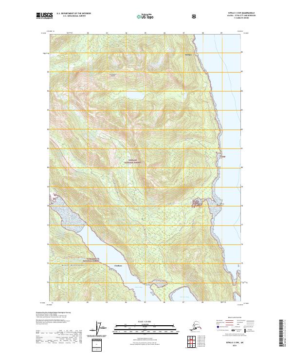
2021 Map of Sitka C-3 SW
USGS Topo · Published 2021About this map
Chichagof Island serves as the backdrop for this modern survey of the coastal wilderness within the Tongass National Forest. The landscape is dominated by the steep rises of the Moore Mountains and the intricate shoreline where the rainforest meets the sea at Florence Bay and Sitkoh Bay. Evidence of the region’s maritime and industrial history appears at the Sitkoh Cannery road, situated near the southern reach of the map. Access into the dense interior is traced by forest routes such as the Sitkoh Lake Trl and various logging spurs like West Fork White Rock. The transition from the high ridges of White Rock down to the inlet at Chatham illustrates the topographic complexity of the Alexander Archipelago, showing how local navigation and industry are tied to these deep-water fjords.
Find a feature on this map
24 named features on this map. Tap any name to fly to it.
Don’t see what you’re looking for? This feature index may not catch every label — zoom into the map to look around manually.
Map Details
Editions of this 2021 Sitka C-3 SW Map
This is the sole edition of this map. No revisions or reprints were ever made.
Other maps of this area

1948 · Sitka B-3
USGS Topo · 1:63,360

1948 · Sitka C-3
USGS Topo · 1:63,360

1951 · Sitka B-4
USGS Topo · 1:63,360

1951 · Sitka C-4
USGS Topo · 1:63,360

1951 · Sitka
USGS Topo · 1:250,000

1951 · Sitka B-3
USGS Topo · 1:63,360

1951 · Sitka C-3
USGS Topo · 1:63,360

1952 · Sitka
USGS Topo · 1:250,000

1964 · Sitka
USGS Topo · 1:250,000
1997 · Sitka C-3
USGS Topo · 1:63,360