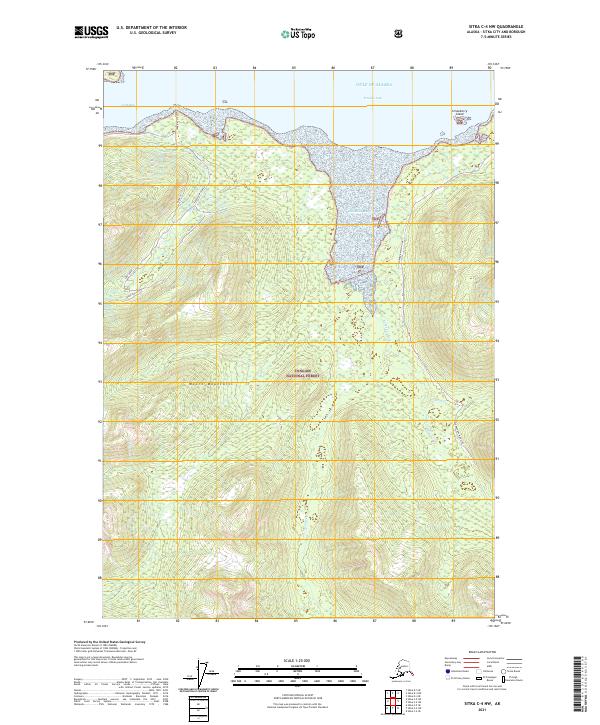
2021 Map of Sitka C-4 NW
USGS Topo · Published 2021About this map
Tongass National Forest dominates the coastal landscape along the Gulf of Alaska on this 2021 survey. The northern shoreline is defined by the deep waters of Tenakee Inlet and Crab Bay, where Strawberry Island sits just offshore. Inland, the high peaks of the Moore Mountains rise above a network of waterways including the Kadashan River, Hook Cr, and Tonalite Cr. The map details a complex system of forestry and access routes, such as the Corner Bay Main Line, Crab Bay Ltf Spur, and Kadashan Crab East. These roads and spurs weave through designated timber harvest areas identified as Block 16 and Block 22, illustrating the intersection of maritime geography and modern timber resource management in the Alaskan panhandle.
Find a feature on this map
23 named features on this map. Tap any name to fly to it.
Don’t see what you’re looking for? This feature index may not catch every label — zoom into the map to look around manually.
Map Details
Editions of this 2021 Sitka C-4 NW Map
This is the sole edition of this map. No revisions or reprints were ever made.
Other maps of this area

1948 · Sitka D-5
USGS Topo · 1:63,360

1948 · Sitka D-4
USGS Topo · 1:63,360

1951 · Sitka C-5
USGS Topo · 1:63,360

1951 · Sitka C-4
USGS Topo · 1:63,360

1951 · Sitka
USGS Topo · 1:250,000

1951 · Sitka D-5
USGS Topo · 1:63,360

1952 · Sitka
USGS Topo · 1:250,000

1955 · Sitka D-4
USGS Topo · 1:63,360

1964 · Sitka
USGS Topo · 1:250,000
1997 · Sitka D-4
USGS Topo · 1:63,360