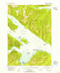
1951 Map of Sitka C-5
USGS Topo · Published 1956About this map
Chichagof Island and the northern reaches of Baranof Island converge at the narrow maritime passages of Peril Strait and Deadman Reach. This mid-century coastal survey illustrates the intricate waterway network of the Alexander Archipelago, where the Duffield Peninsula separates major channels. The landscape is dominated by the steep elevations of the Moore Mountains and Finger Mtn, falling away to coastal features like Poison Cove and Favorite Anchorage.
Find a feature on this map
43 named features on this map. Tap any name to fly to it.
Don’t see what you’re looking for? This feature index may not catch every label — zoom into the map to look around manually.
Map Details
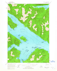
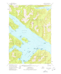
Editions of this 1951 Sitka C-5 Map
4 editions found
Historical Maps of Sitka Through Time
247 maps found

1948 Port Alexander A-2
Sitka Borough, AK

1948 Port Alexander A-3
Sitka Borough, AK

1948 Port Alexander B-2
Sitka Borough, AK

1948 Sitka A-3
Sitka Borough, AK

1948 Sitka A-5
Sitka Borough, AK

1948 Sitka B-3
Sitka Borough, AK

1948 Sitka B-5
Sitka Borough, AK

1948 Sitka C-3
Sitka Borough, AK

1948 Sitka C-6
Sitka Borough, AK

1948 Sitka C-7
Sitka Borough, AK

1948 Sitka D-6
Sitka Borough, AK

1951 Port Alexander A-2
Sitka Borough, AK

1951 Port Alexander A-3
Sitka Borough, AK

1951 Port Alexander B-2
Sitka Borough, AK

1951 Port Alexander B-3 and B-4
Sitka Borough, AK

1951 Port Alexander C-2
Sitka Borough, AK

1951 Port Alexander C-3
Sitka Borough, AK

1951 Port Alexander C-4
Sitka Borough, AK

1951 Port Alexander D-3
Sitka Borough, AK

1951 Port Alexander D-4
Sitka Borough, AK

1951 Port Alexander D-5
Sitka Borough, AK

1951 Port Alexander
Sitka Borough, AK

1951 Sitka A-3
Sitka Borough, AK

1951 Sitka A-4
Sitka Borough, AK

1951 Sitka A-5
Sitka Borough, AK

1951 Sitka A-6
Sitka Borough, AK

1951 Sitka B-3
Sitka Borough, AK

1951 Sitka B-4
Sitka Borough, AK

1951 Sitka B-5
Sitka Borough, AK

1951 Sitka B-6
Sitka Borough, AK

1951 Sitka C-3
Sitka Borough, AK

1951 Sitka C-4
Sitka Borough, AK

1951 Sitka C-5
Sitka Borough, AK

1951 Sitka C-6
Sitka Borough, AK

1951 Sitka C-7
Sitka Borough, AK

1951 Sitka D-6
Sitka Borough, AK

1952 Port Alexander
Sitka Borough, AK

1954 Sitka A-4
Sitka Borough, AK

1964 Port Alexander
Sitka Borough, AK

1987 Sitka A-4 SW
Sitka Borough, AK

1987 Sitka A-5 SE
Sitka Borough, AK

1994 Port Alexander C-3
Sitka Borough, AK

1994 Port Alexander C-4
Sitka Borough, AK

1994 Sitka C-7
Sitka Borough, AK

1995 Port Alexander D-3
Sitka Borough, AK

1996 Sitka A-3
Sitka Borough, AK

1996 Sitka A-5
Sitka Borough, AK

1996 Sitka B-5
Sitka Borough, AK

1996 Sitka B-6
Sitka Borough, AK

1997 Sitka B-3
Sitka Borough, AK

1997 Sitka C-3
Sitka Borough, AK

2000 Sitka D-6
Sitka Borough, AK

2017 Port Alexander A-2 NW
Sitka Borough, AK

2017 Port Alexander A-3 NE
Sitka Borough, AK

2017 Port Alexander B-2 NW
Sitka Borough, AK

2017 Port Alexander B-2 SW
Sitka Borough, AK

2017 Port Alexander B-3 NE
Sitka Borough, AK

2017 Port Alexander B-3 NW
Sitka Borough, AK

2017 Port Alexander B-3 SE
Sitka Borough, AK

2017 Port Alexander B-3 SW
Sitka Borough, AK

2017 Port Alexander B-4 NE
Sitka Borough, AK

2017 Port Alexander C-2 NE
Sitka Borough, AK

2017 Port Alexander C-2 NW
Sitka Borough, AK

2017 Port Alexander C-2 SW
Sitka Borough, AK

2017 Port Alexander C-3 NE
Sitka Borough, AK

2017 Port Alexander C-3 NW
Sitka Borough, AK

2017 Port Alexander C-3 SE
Sitka Borough, AK

2017 Port Alexander C-3 SW
Sitka Borough, AK

2017 Port Alexander C-4 NE
Sitka Borough, AK

2017 Port Alexander C-4 NW
Sitka Borough, AK

2017 Port Alexander C-4 SE
Sitka Borough, AK

2017 Port Alexander D-2 SW
Sitka Borough, AK

2017 Port Alexander D-3 NE
Sitka Borough, AK

2017 Port Alexander D-3 NW
Sitka Borough, AK

2017 Port Alexander D-3 SE
Sitka Borough, AK

2017 Port Alexander D-3 SW
Sitka Borough, AK

2017 Port Alexander D-4 NE
Sitka Borough, AK

2017 Port Alexander D-4 NW
Sitka Borough, AK

2017 Port Alexander D-4 SE
Sitka Borough, AK

2017 Port Alexander D-4 SW
Sitka Borough, AK

2017 Port Alexander D-5 NE
Sitka Borough, AK

2017 Port Alexander D-5 NW
Sitka Borough, AK

2017 Port Alexander D-5 SE
Sitka Borough, AK

2017 Port Alexander D-5 SW
Sitka Borough, AK

2017 Sitka A-3 NE
Sitka Borough, AK

2017 Sitka A-3 NW
Sitka Borough, AK

2017 Sitka A-3 SE
Sitka Borough, AK

2017 Sitka A-3 SW
Sitka Borough, AK

2017 Sitka A-4 NE
Sitka Borough, AK

2017 Sitka A-4 NW
Sitka Borough, AK

2017 Sitka A-4 SE
Sitka Borough, AK

2017 Sitka A-4 SW
Sitka Borough, AK

2017 Sitka A-5 NE
Sitka Borough, AK

2017 Sitka A-5 NW
Sitka Borough, AK

2017 Sitka A-5 SE
Sitka Borough, AK

2017 Sitka A-5 SW
Sitka Borough, AK

2017 Sitka A-6 NE
Sitka Borough, AK

2017 Sitka A-6 NW
Sitka Borough, AK

2017 Sitka A-6 OE S NE
Sitka Borough, AK

2017 Sitka A-6 OE S NW
Sitka Borough, AK

2017 Sitka A-6 SE
Sitka Borough, AK

2017 Sitka A-6 SW
Sitka Borough, AK

2017 Sitka B-3 NE
Sitka Borough, AK

2017 Sitka B-3 NW
Sitka Borough, AK

2017 Sitka B-3 SE
Sitka Borough, AK

2017 Sitka B-3 SW
Sitka Borough, AK

2017 Sitka B-4 NE
Sitka Borough, AK

2017 Sitka B-4 NW
Sitka Borough, AK

2017 Sitka B-4 SE
Sitka Borough, AK

2017 Sitka B-4 SW
Sitka Borough, AK

2017 Sitka B-5 NE
Sitka Borough, AK

2017 Sitka B-5 NW
Sitka Borough, AK

2017 Sitka B-5 SE
Sitka Borough, AK

2017 Sitka B-5 SW
Sitka Borough, AK

2017 Sitka B-6 NE
Sitka Borough, AK

2017 Sitka B-6 NW
Sitka Borough, AK

2017 Sitka B-6 SE
Sitka Borough, AK

2017 Sitka B-6 SW
Sitka Borough, AK

2017 Sitka C-3 NE
Sitka Borough, AK

2017 Sitka C-3 NW
Sitka Borough, AK

2017 Sitka C-3 SE
Sitka Borough, AK

2017 Sitka C-3 SW
Sitka Borough, AK

2017 Sitka C-4 NE
Sitka Borough, AK

2017 Sitka C-4 NW
Sitka Borough, AK

2017 Sitka C-4 SE
Sitka Borough, AK

2017 Sitka C-4 SW
Sitka Borough, AK

2017 Sitka C-5 NE
Sitka Borough, AK

2017 Sitka C-5 NW
Sitka Borough, AK

2017 Sitka C-5 SE
Sitka Borough, AK

2017 Sitka C-5 SW
Sitka Borough, AK

2017 Sitka C-6 NE
Sitka Borough, AK

2017 Sitka C-6 NW
Sitka Borough, AK

2017 Sitka C-6 SE
Sitka Borough, AK

2017 Sitka C-6 SW
Sitka Borough, AK

2017 Sitka C-7 NE
Sitka Borough, AK

2017 Sitka C-7 NW
Sitka Borough, AK

2017 Sitka C-7 OE S NE
Sitka Borough, AK

2017 Sitka C-7 SE
Sitka Borough, AK

2017 Sitka D-5 SE
Sitka Borough, AK

2017 Sitka D-5 SW
Sitka Borough, AK

2017 Sitka D-6 NE
Sitka Borough, AK

2017 Sitka D-6 NW
Sitka Borough, AK

2017 Sitka D-6 SE
Sitka Borough, AK

2017 Sitka D-6 SW
Sitka Borough, AK

2017 Sitka D-7 SE
Sitka Borough, AK

2017 Sitka D-7 SW
Sitka Borough, AK

2017 Sitka D-8 SE
Sitka Borough, AK

2018 Port Alexander C-4 OE W NE
Sitka Borough, AK

2018 Port Alexander C-4 SW
Sitka Borough, AK

2021 Port Alexander A-2 NW
Sitka Borough, AK

2021 Port Alexander A-3 NE
Sitka Borough, AK

2021 Port Alexander B-2 NW
Sitka Borough, AK

2021 Port Alexander B-2 SW
Sitka Borough, AK

2021 Port Alexander B-3 NE
Sitka Borough, AK

2021 Port Alexander B-3 NW
Sitka Borough, AK

2021 Port Alexander B-3 SE
Sitka Borough, AK

2021 Port Alexander B-3 SW
Sitka Borough, AK

2021 Port Alexander B-4 NE
Sitka Borough, AK

2021 Port Alexander C-2 NE
Sitka Borough, AK

2021 Port Alexander C-2 NW
Sitka Borough, AK

2021 Port Alexander C-2 SW
Sitka Borough, AK

2021 Port Alexander C-3 NE
Sitka Borough, AK

2021 Port Alexander C-3 NW
Sitka Borough, AK

2021 Port Alexander C-3 SE
Sitka Borough, AK

2021 Port Alexander C-3 SW
Sitka Borough, AK

2021 Port Alexander C-4 NE
Sitka Borough, AK

2021 Port Alexander C-4 NW
Sitka Borough, AK

2021 Port Alexander C-4 OE W NE
Sitka Borough, AK

2021 Port Alexander C-4 SE
Sitka Borough, AK

2021 Port Alexander D-2 SW
Sitka Borough, AK

2021 Port Alexander D-3 NE
Sitka Borough, AK

2021 Port Alexander D-3 NW
Sitka Borough, AK

2021 Port Alexander D-3 SE
Sitka Borough, AK

2021 Port Alexander D-3 SW
Sitka Borough, AK

2021 Port Alexander D-4 NE
Sitka Borough, AK

2021 Port Alexander D-4 NW
Sitka Borough, AK

2021 Port Alexander D-4 SE
Sitka Borough, AK

2021 Port Alexander D-4 SW
Sitka Borough, AK

2021 Port Alexander D-5 NE
Sitka Borough, AK

2021 Port Alexander D-5 NW
Sitka Borough, AK

2021 Port Alexander D-5 SE
Sitka Borough, AK

2021 Port Alexander D-5 SW
Sitka Borough, AK

2021 Sitka A-3 NE
Sitka Borough, AK

2021 Sitka A-3 NW
Sitka Borough, AK

2021 Sitka A-3 SE
Sitka Borough, AK

2021 Sitka A-3 SW
Sitka Borough, AK

2021 Sitka A-4 NE
Sitka Borough, AK

2021 Sitka A-4 NW
Sitka Borough, AK

2021 Sitka A-4 SE
Sitka Borough, AK

2021 Sitka A-4 SW
Sitka Borough, AK

2021 Sitka A-5 NE
Sitka Borough, AK

2021 Sitka A-5 NW
Sitka Borough, AK

2021 Sitka A-5 SE
Sitka Borough, AK

2021 Sitka A-5 SW
Sitka Borough, AK

2021 Sitka A-6 NE
Sitka Borough, AK

2021 Sitka A-6 NW
Sitka Borough, AK

2021 Sitka A-6 OE S NE
Sitka Borough, AK

2021 Sitka A-6 OE S NW
Sitka Borough, AK

2021 Sitka A-6 SE
Sitka Borough, AK

2021 Sitka A-6 SW
Sitka Borough, AK

2021 Sitka B-3 NE
Sitka Borough, AK

2021 Sitka B-3 NW
Sitka Borough, AK

2021 Sitka B-3 SE
Sitka Borough, AK

2021 Sitka B-3 SW
Sitka Borough, AK

2021 Sitka B-4 NE
Sitka Borough, AK

2021 Sitka B-4 NW
Sitka Borough, AK

2021 Sitka B-4 SE
Sitka Borough, AK

2021 Sitka B-4 SW
Sitka Borough, AK

2021 Sitka B-5 NE
Sitka Borough, AK

2021 Sitka B-5 NW
Sitka Borough, AK

2021 Sitka B-5 SE
Sitka Borough, AK

2021 Sitka B-5 SW
Sitka Borough, AK

2021 Sitka B-6 NE
Sitka Borough, AK

2021 Sitka B-6 NW
Sitka Borough, AK

2021 Sitka B-6 SE
Sitka Borough, AK

2021 Sitka B-6 SW
Sitka Borough, AK

2021 Sitka C-3 NE
Sitka Borough, AK

2021 Sitka C-3 NW
Sitka Borough, AK

2021 Sitka C-3 SE
Sitka Borough, AK

2021 Sitka C-3 SW
Sitka Borough, AK

2021 Sitka C-4 NE
Sitka Borough, AK

2021 Sitka C-4 NW
Sitka Borough, AK

2021 Sitka C-4 SE
Sitka Borough, AK

2021 Sitka C-4 SW
Sitka Borough, AK

2021 Sitka C-5 NE
Sitka Borough, AK

2021 Sitka C-5 NW
Sitka Borough, AK

2021 Sitka C-5 SE
Sitka Borough, AK

2021 Sitka C-5 SW
Sitka Borough, AK

2021 Sitka C-6 NE
Sitka Borough, AK

2021 Sitka C-6 NW
Sitka Borough, AK

2021 Sitka C-6 SE
Sitka Borough, AK

2021 Sitka C-6 SW
Sitka Borough, AK

2021 Sitka C-7 NE
Sitka Borough, AK

2021 Sitka C-7 NW
Sitka Borough, AK

2021 Sitka C-7 OE S NE
Sitka Borough, AK

2021 Sitka C-7 SE
Sitka Borough, AK

2021 Sitka D-5 SE
Sitka Borough, AK

2021 Sitka D-5 SW
Sitka Borough, AK

2021 Sitka D-6 NE
Sitka Borough, AK

2021 Sitka D-6 NW
Sitka Borough, AK

2021 Sitka D-6 SE
Sitka Borough, AK

2021 Sitka D-6 SW
Sitka Borough, AK

2021 Sitka D-7 SE
Sitka Borough, AK

2021 Sitka D-7 SW
Sitka Borough, AK

2021 Sitka D-8 SE
Sitka Borough, AK

2024 Sitka C-3 NE
Sitka Borough, AK

2024 Sitka C-3 SE
Sitka Borough, AK