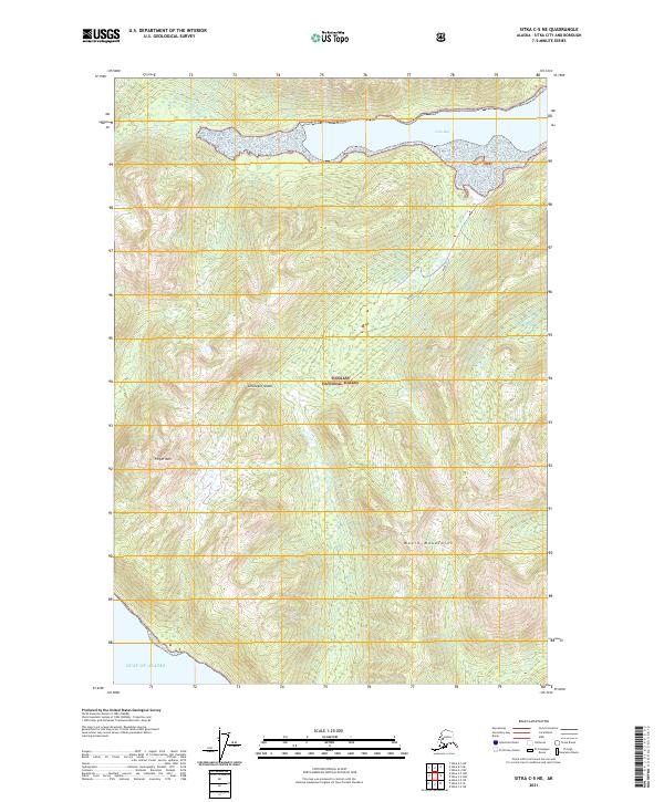
2021 Map of Sitka C-5 NE
USGS Topo · Published 2021About this map
Chichagof Island dominates this 2021 survey, showcasing a landscape defined by the dense wilderness of the Tongass National Forest. The topography is shaped by the Moore Mountains in the south and the prominent Finger Mtn to the west, while the northern shoreline is deeply indented by Crab Bay. This map provides a detailed view of the uninhabited interior and coastal interfaces of the Sitka City and Borough, where the land finally meets the open waters of the Gulf of Alaska at its southwestern edge. The lack of roads or established settlements emphasizes the remote nature of this island terrain, preserved within the national forest system. Researchers can trace the drainage patterns and elevation contours across various townships, including t47s r62e and t48s r61e, which illustrate the complex physical geography of the Alexander Archipelago.
Find a feature on this map
12 named features on this map. Tap any name to fly to it.
Don’t see what you’re looking for? This feature index may not catch every label — zoom into the map to look around manually.
Map Details
Editions of this 2021 Sitka C-5 NE Map
This is the sole edition of this map. No revisions or reprints were ever made.
Other maps of this area

1948 · Sitka D-5
USGS Topo · 1:63,360

1948 · Sitka D-4
USGS Topo · 1:63,360

1951 · Sitka C-5
USGS Topo · 1:63,360

1951 · Sitka C-4
USGS Topo · 1:63,360

1951 · Sitka
USGS Topo · 1:250,000

1951 · Sitka D-5
USGS Topo · 1:63,360

1952 · Sitka
USGS Topo · 1:250,000

1955 · Sitka D-4
USGS Topo · 1:63,360

1964 · Sitka
USGS Topo · 1:250,000
1997 · Sitka D-4
USGS Topo · 1:63,360