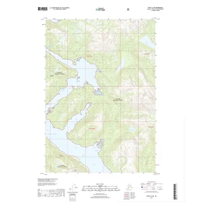
2017 Map of Sitka C-6 SW
USGS Topo · Published 2017About this map
The complex coastline of West Chichagof-Yakobi Wilderness within the Tongass National Forest is defined by deep fjords and maritime landmarks. Long tidal inlets including Falcon Arm, Slocum Arm, and Ford Arm reach into the mountainous terrain, creating a network of protected waters and narrow peninsulas. Notable landmarks like the Khaz Peninsula and Takeena Peninsula separate these waterways, while the interior is dominated by elevations such as Khaz Peak and Flat Top Mtn.
Find a feature on this map
16 named features on this map. Tap any name to fly to it.
Don’t see what you’re looking for? This feature index may not catch every label — zoom into the map to look around manually.
Map Details
Editions of this 2017 Sitka C-6 SW Map
This is the sole edition of this map. No revisions or reprints were ever made.
Other maps of this area

1948 · Sitka C-7
USGS Topo · 1:63,360

1948 · Sitka C-6
USGS Topo · 1:63,360

1951 · Sitka B-6
USGS Topo · 1:63,360

1951 · Sitka
USGS Topo · 1:250,000

1951 · Sitka C-6
USGS Topo · 1:63,360

1951 · Sitka C-7
USGS Topo · 1:63,360

1952 · Sitka
USGS Topo · 1:250,000

1964 · Sitka
USGS Topo · 1:250,000
1994 · Sitka C-7
USGS Topo · 1:63,360
1996 · Sitka B-6
USGS Topo · 1:63,360