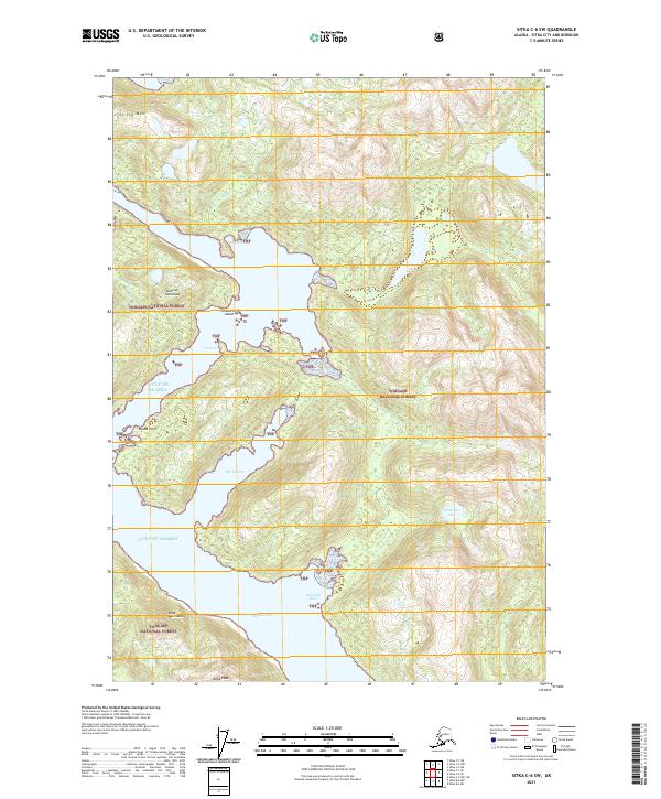
2021 Map of Sitka C-6 SW
USGS Topo · Published 2021About this map
Tongass National Forest dominates this coastal landscape where the Gulf of Alaska meets the intricately carved shoreline of Chichagof Island. The geography is defined by narrow inlets and protective peninsulas, such as the Takeena Peninsula and Khaz Peninsula, which create sheltered waters like Rocky Bay and Falcon Arm. Inland, the terrain rises sharply toward Flat Top Mtn and Khaz Peak, with freshwater features like Waterfall Lake draining into the saltwater of Waterfall Cove. The mapping of these deep inlets and offshore markers like Channel Island and Round Point highlights a maritime environment where water access dictates movement. This survey reflects the complex interface of old-growth forest and the Pacific, providing a precise record of the natural harbors and topographic peaks that characterize this part of the Sitka City and Borough.
Find a feature on this map
20 named features on this map. Tap any name to fly to it.
Don’t see what you’re looking for? This feature index may not catch every label — zoom into the map to look around manually.
Map Details
Editions of this 2021 Sitka C-6 SW Map
This is the sole edition of this map. No revisions or reprints were ever made.
Other maps of this area

1948 · Sitka C-7
USGS Topo · 1:63,360

1948 · Sitka C-6
USGS Topo · 1:63,360

1951 · Sitka B-6
USGS Topo · 1:63,360

1951 · Sitka
USGS Topo · 1:250,000

1951 · Sitka C-6
USGS Topo · 1:63,360

1951 · Sitka C-7
USGS Topo · 1:63,360

1952 · Sitka
USGS Topo · 1:250,000

1964 · Sitka
USGS Topo · 1:250,000
1994 · Sitka C-7
USGS Topo · 1:63,360
1996 · Sitka B-6
USGS Topo · 1:63,360