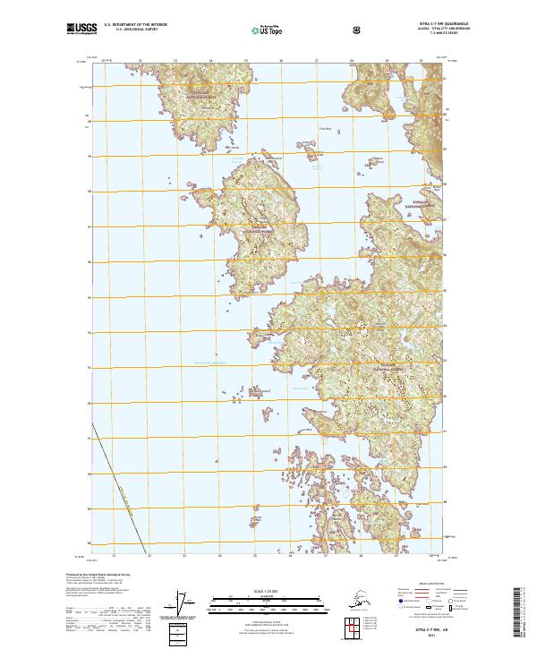
2021 Map of Sitka C-7 NW
USGS Topo · Published 2021About this map
The Tongass National Forest encompasses this intricate coastal landscape within the Sitka City and Borough, where the rugged archipelago meets the Gulf of Alaska. Navigational passages such as Imperial Passage and South Passage thread between numerous landmasses, including the prominent Hill Island, Hogan Island, and Herbert Graves Island. The maritime character of the region is defined by complex shorelines featuring Portlock Harbor and Kukkan Bay. Numerous small outcroppings and hazards like White Sisters, Minnie Reef, and Snipe Rock dot the coastal waters, illustrating the challenging geography of the Alexander Archipelago. This survey provides a contemporary view of the region's protected wilderness and its labyrinthine waterways before they transition into the open sea at Cape Edward.
Find a feature on this map
38 named features on this map. Tap any name to fly to it.
Don’t see what you’re looking for? This feature index may not catch every label — zoom into the map to look around manually.
Map Details
Editions of this 2021 Sitka C-7 NW Map
This is the sole edition of this map. No revisions or reprints were ever made.
Other maps of this area

1948 · Sitka C-7
USGS Topo · 1:63,360

1948 · Sitka D-8
USGS Topo · 1:63,360

1950 · Sitka D-8
USGS Topo · 1:63,360

1951 · Sitka D-7
USGS Topo · 1:63,360

1951 · Sitka
USGS Topo · 1:250,000

1951 · Sitka C-7
USGS Topo · 1:63,360

1952 · Sitka
USGS Topo · 1:250,000

1964 · Sitka
USGS Topo · 1:250,000
1994 · Sitka C-7
USGS Topo · 1:63,360
1995 · Sitka D-8
USGS Topo · 1:63,360