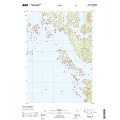
2017 Map of Sitka C-7 SE
USGS Topo · Published 2017About this map
Tongass National Forest dominates the maritime landscape of this coastal quadrangle, where the complex island systems of Southeast Alaska meet the open Gulf of Alaska. The intricate archipelago is defined by navigable waterways like Elbow Passage, Rough Channel, and Smooth Channel, which weave around prominent landmasses such as Klag Island and Vorota Island. This coastal environment is marked by significant topographical landmarks, including the high ground of Flat Top Mtn and the extended reaches of the Takeena Peninsula and Khaz Peninsula.
Find a feature on this map
42 named features on this map. Tap any name to fly to it.
Don’t see what you’re looking for? This feature index may not catch every label — zoom into the map to look around manually.
Map Details
Editions of this 2017 Sitka C-7 SE Map
This is the sole edition of this map. No revisions or reprints were ever made.
Other maps of this area

1948 · Sitka C-7
USGS Topo · 1:63,360

1948 · Sitka C-6
USGS Topo · 1:63,360

1951 · Sitka B-6
USGS Topo · 1:63,360

1951 · Sitka
USGS Topo · 1:250,000

1951 · Sitka C-6
USGS Topo · 1:63,360

1951 · Sitka C-7
USGS Topo · 1:63,360

1952 · Sitka
USGS Topo · 1:250,000

1964 · Sitka
USGS Topo · 1:250,000
1994 · Sitka C-7
USGS Topo · 1:63,360
1996 · Sitka B-6
USGS Topo · 1:63,360