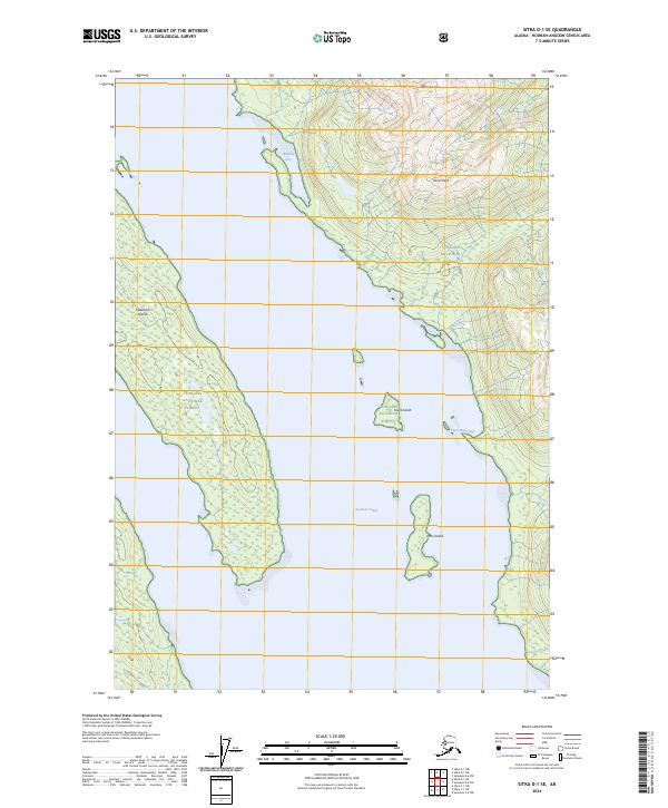
2024 Map of Sitka D-1 SE
USGS Topo · Published 2024About this map
Kootznoowoo Wilderness dominates this coastal landscape on Admiralty Island, where steep topography meets the intricate shoreline of the Alexander Archipelago. This modern survey illustrates a strictly preserved environment protected within the Admiralty Island National Monument and the Tongass National Forest. High points like Randolph Peak and Morse Peak overlook the deep waters of Seymour Canal, which divides the main landmass from significant coastal features including Tiedeman Island and Dorn Island. The mapping reflects a landscape defined by natural boundaries and maritime access points such as Winning Cove and Short Finger Bay, showing the intersection of federal conservation lands and the complex interior waterways of Southeast Alaska. The absence of roads or permanent settlements emphasizes the region's character as a managed wilderness area, where geological features and old-growth forest systems are the primary focus.
Find a feature on this map
15 named features on this map. Tap any name to fly to it.
Don’t see what you’re looking for? This feature index may not catch every label — zoom into the map to look around manually.
Map Details
Editions of this 2024 Sitka D-1 SE Map
This is the sole edition of this map. No revisions or reprints were ever made.
Other maps of this area

1948 · Sitka D-1
USGS Topo · 1:63,360

1948 · Sitka C-1
USGS Topo · 1:63,360

1948 · Sumdum D-6
USGS Topo · 1:63,360

1948 · Sumdum C-6
USGS Topo · 1:63,360

1951 · Sitka
USGS Topo · 1:250,000

1951 · Sitka D-1
USGS Topo · 1:63,360

1951 · Sumdum D-6
USGS Topo · 1:63,360

1951 · Sitka C-1
USGS Topo · 1:63,360

1951 · Sumdum C-6
USGS Topo · 1:63,360

1952 · Sumdum
USGS Topo · 1:250,000