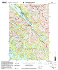
1997 Map of Sitka D-7
USGS Topo · Published 2000About this map
Lisianski Inlet serves as the central artery for this remote portion of Chichagof Island, anchoring the small boardwalk community of Pelican. This 1990s revision reveals the maritime infrastructure supporting the region, from the Alaska Marine Highway route to navigation aids like Pelican Harbor Light and Knox Light. The landscape is a mix of active forest management and preserved wilderness, with the West Chichagof - Yakobi Wilderness protecting large tracts of the southwestern coast.
Find a feature on this map
65 named features on this map. Tap any name to fly to it.
Don’t see what you’re looking for? This feature index may not catch every label — zoom into the map to look around manually.
Map Details
Editions of this 1997 Sitka D-7 Map
This is the sole edition of this map. No revisions or reprints were ever made.
Other maps of this area

1948 · Sitka C-7
USGS Topo · 1:63,360

1948 · Mount Fairweather A-2
USGS Topo · 1:63,360

1948 · Sitka C-6
USGS Topo · 1:63,360

1948 · Sitka D-6
USGS Topo · 1:63,360

1948 · Sitka D-8
USGS Topo · 1:63,360

1948 · Mount Fairweather A-1
USGS Topo · 1:63,360

1950 · Sitka D-8
USGS Topo · 1:63,360

1951 · Juneau
USGS Topo · 1:250,000

1951 · Juneau A-6
USGS Topo · 1:63,360

1951 · Sitka D-7
USGS Topo · 1:63,360