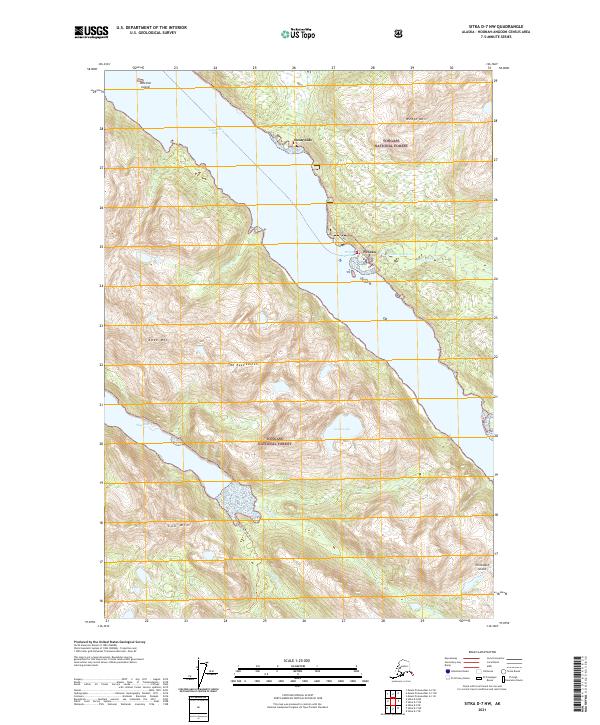
2021 Map of Sitka D-7 NW
USGS Topo · Published 2021About this map
Pelican sits on the eastern shore of Lisianski Inlet, serving as a focal point for maritime activity in this part of Chichagof Island. The map illustrates the town’s infrastructure, including Pelican Harbor, the Pelican Reservoir, and Pelican Cr, nestled under the steep slopes of Wedge Mtn. To the north, the settlement of Sunnyside occupies a small coastal shelf, while further south, the Stag River flows into the head of Stag Bay.
Find a feature on this map
25 named features on this map. Tap any name to fly to it.
Don’t see what you’re looking for? This feature index may not catch every label — zoom into the map to look around manually.
Map Details
Editions of this 2021 Sitka D-7 NW Map
This is the sole edition of this map. No revisions or reprints were ever made.
Other maps of this area

1948 · Mount Fairweather A-2
USGS Topo · 1:63,360

1948 · Sitka D-8
USGS Topo · 1:63,360

1948 · Mount Fairweather A-1
USGS Topo · 1:63,360

1950 · Sitka D-8
USGS Topo · 1:63,360

1951 · Sitka D-7
USGS Topo · 1:63,360

1951 · Mt Fairweather
USGS Topo · 1:250,000

1951 · Sitka
USGS Topo · 1:250,000

1952 · Sitka
USGS Topo · 1:250,000

1954 · Mount Fairweather A-1
USGS Topo · 1:63,360

1961 · Mt Fairweather
USGS Topo · 1:250,000