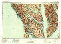
1952 Map of Sitka
USGS Topo · Published 1955About this map
Sitka Sound anchors this mid-century topographic survey of the Alexander Archipelago, showing the critical maritime corridors of Southeast Alaska before modern development reshaped the coastal experience. The map details the intricate waterways of Peril Strait and Chatham Strait, which served as the primary highways for the region's fishing and mining industries. On Kruzof Island, the dormant volcano Mt Edgecumbe stands as a prominent landmark for navigators entering from the Pacific Ocean. Settlement patterns are concentrated in small coastal enclaves such as Sitka, Angoon, and the boardwalk community of Tenakee, reflecting an era when transportation was almost exclusively waterborne. Notable industrial markers include Gypsum on Chichagof Island, pointing to the extractive history of the area. The vast coverage within the Tongass National Forest illustrates the dense, undeveloped wilderness spanning from Lisianski Inlet to Stephens Passage, offering a view of the First Judicial Division's geography during a period of transition in the 1950s.
Find a feature on this map
45 named features on this map. Tap any name to fly to it.
Don’t see what you’re looking for? This feature index may not catch every label — zoom into the map to look around manually.
Map Details
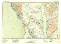
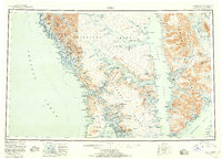
Editions of this 1952 Sitka Map
4 editions found

Other maps of this area

1948 · Juneau A-3
USGS Topo · 1:63,360

1948 · Sitka B-3
USGS Topo · 1:63,360

1948 · Juneau A-4
USGS Topo · 1:63,360

1948 · Sitka D-1
USGS Topo · 1:63,360

1948 · Sitka B-1
USGS Topo · 1:63,360

1948 · Sitka A-5
USGS Topo · 1:63,360

1948 · Sitka A-3
USGS Topo · 1:63,360

1948 · Sitka C-7
USGS Topo · 1:63,360

1948 · Sitka C-2
USGS Topo · 1:63,360

1948 · Sitka A-2
USGS Topo · 1:63,360