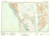
1952 Map of Sitka
USGS Topo · Published 1958About this map
Sitka serves as the focal point of this coastal survey, which details the intricate archipelago of Southeast Alaska before significant modern development. The map illustrates a maritime landscape defined by isolated settlements and resource extraction, with Mines located near Kimshan Cove and Bohemia Basin. These labels reflect the region's mid-century reliance on seasonal industry and seafaring trade. Inland, the mountainous terrain of Chichagof Island and Baranof Island is marked by prominent peaks such as Mt Edgecumbe and Annahootz Mtn, while the complex waterways of Peril Strait and Chatham Strait link scattered outposts like Angoon, Killisnoo, and Tenakee Springs. The inclusion of White Sulphur Springs and Warm Spring Bay highlights the natural geothermal features that drew early visitors and residents to these remote coastal reaches.
Find a feature on this map
65 named features on this map. Tap any name to fly to it.
Don’t see what you’re looking for? This feature index may not catch every label — zoom into the map to look around manually.
Map Details
Editions of this 1952 Sitka Map
4 editions found

Other maps of this area

1948 · Juneau A-3
USGS Topo · 1:63,360

1948 · Sitka B-3
USGS Topo · 1:63,360

1948 · Juneau A-4
USGS Topo · 1:63,360

1948 · Sitka D-1
USGS Topo · 1:63,360

1948 · Sitka B-1
USGS Topo · 1:63,360

1948 · Sitka A-5
USGS Topo · 1:63,360

1948 · Sitka A-3
USGS Topo · 1:63,360

1948 · Sitka C-7
USGS Topo · 1:63,360

1948 · Sitka C-2
USGS Topo · 1:63,360

1948 · Sitka A-2
USGS Topo · 1:63,360