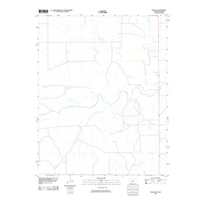
2010 Map of Sitka SW
USGS Topo · Published 2010About this map
The Cimarron River winds through this rural section of Clark County, defining a landscape shaped by its many tributaries. This 2010 survey by the U.S. Geological Survey documents the drainage patterns of the High Plains, where several named waterways converge toward the main river channel. Watercourses like Bear Creek, Day Creek, and Spring Creek etch their paths through the terrain, illustrating the natural irrigation and erosion patterns typical of the Kansas-Oklahoma border region. Beyond the water, the human footprint is primarily marked by a sparse network of section-line roads, including E0010 Rd, and the southern flow of Snake Creek. The map provides a clear look at the undeveloped character of this prairie landscape before more modern industrial or agricultural expansions altered the rural isolation of the plains.
Find a feature on this map
6 named features on this map. Tap any name to fly to it.
Don’t see what you’re looking for? This feature index may not catch every label — zoom into the map to look around manually.
Map Details
Editions of this 2010 Sitka SW Map
This is the sole edition of this map. No revisions or reprints were ever made.
Other maps of this area

1894 · Sitka
USGS Topo · 1:62,500

1896 · Ashland
USGS Topo · 1:125,000

1955 · Woodward
USGS Topo · 1:250,000

1955 · Pratt
USGS Topo · 1:250,000

1958 · Woodward
USGS Topo · 1:250,000

1959 · Pratt
USGS Topo · 1:250,000

1970 · Buffalo NW
USGS Topo · 1:24,000

1970 · Rosston NE
USGS Topo · 1:24,000

1970 · Buffalo NE
USGS Topo · 1:24,000
1972 · Ashland SE
USGS Topo · 1:24,000