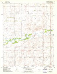
1979 Map of Sitka SW
USGS Topo · Published 1980About this map
The Old Indian Treaty Boundary 1977 cuts a straight path across this southwestern Kansas landscape, marking a significant historical line through the terrain of Sitka. The winding Cimarron River dominates the central portion of the map, flanked by various tributaries including Bear Creek and Spring Creek. This 1970s survey shows a rural environment primarily defined by its natural watercourses and sparse industrial activity, indicated by several scattered Oil Well and Gas Well sites. The convergence of Day Creek and Snake Creek further south highlights the drainage patterns that shaped local land use and boundary lines between Clark and Harper counties.
Find a feature on this map
10 named features on this map. Tap any name to fly to it.
Don’t see what you’re looking for? This feature index may not catch every label — zoom into the map to look around manually.
Map Details
Editions of this 1979 Sitka SW Map
This is the sole edition of this map. No revisions or reprints were ever made.
Other maps of this area

1894 · Sitka
USGS Topo · 1:62,500

1896 · Ashland
USGS Topo · 1:125,000

1955 · Woodward
USGS Topo · 1:250,000

1955 · Pratt
USGS Topo · 1:250,000

1958 · Woodward
USGS Topo · 1:250,000

1959 · Pratt
USGS Topo · 1:250,000

1970 · Buffalo NW
USGS Topo · 1:24,000

1970 · Rosston NE
USGS Topo · 1:24,000

1970 · Buffalo NE
USGS Topo · 1:24,000
1972 · Ashland SE
USGS Topo · 1:24,000