
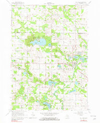
1964 Map of Six Lakes
USGS Topo · Published 1965About this map
Six Lakes serves as the focal point of this mid-Michigan survey, situated at the junction of the Chesapeake and Ohio railroad line and a series of interconnected glacial lakes. The village character is defined by its proximity to First Lake, Second Lake, and Third Lake, which formed part of the regional rail-and-water transport network. The landscape is dotted with numerous gravel pits and small water bodies like Townline Lake and Lake Montcalm, reflecting the post-glacial topography of the Belvidere and Hinton townships. Local heritage is preserved through markers such as the Hillcrest Cem and Fouts Sch, while the southern portion of the quadrangle shows the winding course of the Flat River. An interesting industrial detail is noted near the southern margin with the presence of a Water Wheel along the riverbanks near Lake Forest.
Find a feature on this map
49 named features on this map. Tap any name to fly to it.
Don’t see what you’re looking for? This feature index may not catch every label — zoom into the map to look around manually.
Map Details
Editions of this 1964 Six Lakes Map
2 editions found
Other maps of this area

1954 · Midland
USGS Topo · 1:250,000

1958 · Midland
USGS Topo · 1:250,000

1958 · Big Rapids
USGS Topo · 1:62,500

1959 · Midland
USGS Topo · 1:250,000

1959 · Howard City
USGS Topo · 1:62,500

1964 · Edmore
USGS Topo · 1:24,000

1964 · Blanchard
USGS Topo · 1:24,000

1964 · Langston
USGS Topo · 1:24,000

1964 · Mecosta
USGS Topo · 1:24,000

1964 · Stanton
USGS Topo · 1:24,000