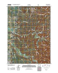
2011 Map of Sixes
USGS Topo · Published 2011About this map
The Sixes River and Elk River drainage basins define this coastal landscape near the Pacific in Curry County. The small community of Sixes serves as a focal point, anchored by the Sixes Post Office near the intersection of several local roads like Sweet Ranch Rd and Sixes River Rd. Further south, the northern edge of Port Orford is visible, featuring Buffington Memorial Park and the nearby Silver Butte. The terrain is marked by distinct topographical features such as Poverty Ridge, Eightmile Prairie, and several peaks including Summit Mountain and Madden Butte. Local water management and land use are evidenced by Richman Reservoir and Marsh Log Pond, while a network of forest and county roads, such as Elk River Rd and Crystal Creek Rd, provide access through the timber-rich hills and along the numerous tributary creeks that feed the primary river systems.
Find a feature on this map
63 named features on this map. Tap any name to fly to it.
Don’t see what you’re looking for? This feature index may not catch every label — zoom into the map to look around manually.
Map Details
Editions of this 2011 Sixes Map
This is the sole edition of this map. No revisions or reprints were ever made.
Other maps of this area

1899 · Port Orford
USGS Topo · 1:125,000

1903 · Port Orford
USGS Topo · 1:125,000

1954 · Coos Bay
USGS Topo · 1:250,000

1954 · Port Orford
USGS Topo · 1:62,500

1954 · Cape Blanco
USGS Topo · 1:62,500

1954 · Langlois
USGS Topo · 1:62,500

1958 · Coos Bay
USGS Topo · 1:250,000

1962 · Coos Bay
USGS Topo · 1:250,000
1985 · Calf Ranch Mtn
USGS Topo · 1:24,000
1986 · Langlois
USGS Topo · 1:24,000