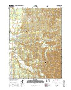
2017 Map of Sixes
USGS Topo · Published 2017About this map
Port Orford sits at the southern edge of this coastal landscape, where the town's grid meets the shores of Garrison Lake and the northern reaches of N Fork Hubbard Cr. The map details a transition from the Pacific coastline into the dense, high-elevation terrain of the Siskiyou National Forest. The settlement of Sixes serves as a central point along the Sixes River, which winds through the valley between Madden Butte and Poverty Ridge.
Find a feature on this map
71 named features on this map. Tap any name to fly to it.
Don’t see what you’re looking for? This feature index may not catch every label — zoom into the map to look around manually.
Map Details
Editions of this 2017 Sixes Map
This is the sole edition of this map. No revisions or reprints were ever made.
Other maps of this area

1899 · Port Orford
USGS Topo · 1:125,000

1903 · Port Orford
USGS Topo · 1:125,000

1954 · Coos Bay
USGS Topo · 1:250,000

1954 · Port Orford
USGS Topo · 1:62,500

1954 · Cape Blanco
USGS Topo · 1:62,500

1954 · Langlois
USGS Topo · 1:62,500

1958 · Coos Bay
USGS Topo · 1:250,000

1962 · Coos Bay
USGS Topo · 1:250,000
1985 · Calf Ranch Mtn
USGS Topo · 1:24,000
1986 · Langlois
USGS Topo · 1:24,000