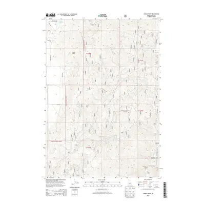
2013 Map of Sixmile Point
USGS Topo · Published 2013About this map
Boise National Forest dominates this mountain landscape in Idaho's Valley County, where the Middle Fork Payette River flows through the southeastern corner. The high-elevation terrain is defined by Sixmile Point and the drainage basins of several waterways, including Sixmile Cr, Bacon Cr, and Wet Foot Cr. Human activity is concentrated around recreational and forest management infrastructure, such as the Herrick Reservoir Public Fishing Area at Herrick Reservoir in the north and several forest access roads like Nat For Dev Rd 418. Local history and recreational patterns are evident in the placement of the Trail Creek Campground and Rattlesnake Campground along the river corridor, while the central portion of the map remains largely roadless timberland within the national forest boundary.
Find a feature on this map
32 named features on this map. Tap any name to fly to it.
Don’t see what you’re looking for? This feature index may not catch every label — zoom into the map to look around manually.
Map Details
Editions of this 2013 Sixmile Point Map
This is the sole edition of this map. No revisions or reprints were ever made.
Other maps of this area

1894 · Squaw Creek
USGS Topo · 1:125,000

1909 · Garden Valley
USGS Topo · 1:125,000

1953 · Smiths Ferry
USGS Topo · 1:62,500

1953 · Boiling Springs
USGS Topo · 1:62,500

1953 · Banks
USGS Topo · 1:62,500

1955 · Baker
USGS Topo · 1:250,000

1957 · Challis
USGS Topo · 1:250,000

1959 · Baker
USGS Topo · 1:250,000

1959 · Garden Valley
USGS Topo · 1:62,500

1960 · Challis
USGS Topo · 1:250,000