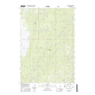
2017 Map of Sixmile Point
USGS Topo · Published 2017About this map
Boise National Forest dominates this section of Valley County, where the high ridges of the North Fork Range separate the Round Valley basin from the Middle Fork Payette River corridor. The geography is defined by a dense network of watercourses including Skunk Creek and Sixmile Creek, which flow through complex terrain marked by prominent landmarks like Sixmile Point and the sprawling Table Mountain. In the south, Hot Springs sits near the river's edge at the foot of Rocky Canyon, illustrating the geothermal character of the region.
Find a feature on this map
53 named features on this map. Tap any name to fly to it.
Don’t see what you’re looking for? This feature index may not catch every label — zoom into the map to look around manually.
Map Details
Editions of this 2017 Sixmile Point Map
This is the sole edition of this map. No revisions or reprints were ever made.
Other maps of this area

1894 · Squaw Creek
USGS Topo · 1:125,000

1909 · Garden Valley
USGS Topo · 1:125,000

1953 · Smiths Ferry
USGS Topo · 1:62,500

1953 · Boiling Springs
USGS Topo · 1:62,500

1953 · Banks
USGS Topo · 1:62,500

1955 · Baker
USGS Topo · 1:250,000

1957 · Challis
USGS Topo · 1:250,000

1959 · Baker
USGS Topo · 1:250,000

1959 · Garden Valley
USGS Topo · 1:62,500

1960 · Challis
USGS Topo · 1:250,000