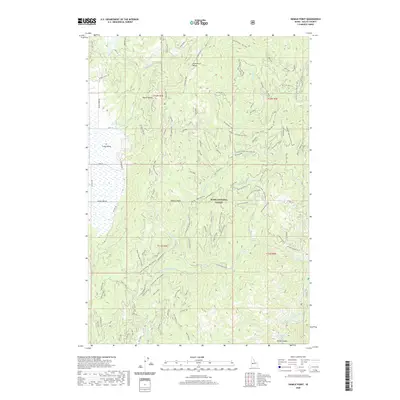
2020 Map of Sixmile Point
USGS Topo · Published 2020About this map
The Boise National Forest dominates this Idaho landscape, characterized by the steep ridges of the North Fork Range and high-altitude features like Sixmile Point. In the southwest corner, the topography transitions toward the broader expanses of Round Valley and Long Valley, where the drainage of Round Valley Cr and Bacon Creek defines the local hydrology. This 2020 record illustrates a complex network of forest access routes, including Herrick Road and the Six Mile D Road, which snake through the Sixmile Highlands. A notable point of interest is the Hot Springs located in Rocky Canyon near the Middle Fork Payette River, representing a rare thermal feature in this timber-rich environment. The map provides a precise look at the drainage patterns of the South Fk of the West Fk and other tributaries feeding the Payette watershed.
Find a feature on this map
86 named features on this map. Tap any name to fly to it.
Don’t see what you’re looking for? This feature index may not catch every label — zoom into the map to look around manually.
Map Details
Editions of this 2020 Sixmile Point Map
This is the sole edition of this map. No revisions or reprints were ever made.
Other maps of this area

1894 · Squaw Creek
USGS Topo · 1:125,000

1909 · Garden Valley
USGS Topo · 1:125,000

1953 · Smiths Ferry
USGS Topo · 1:62,500

1953 · Boiling Springs
USGS Topo · 1:62,500

1953 · Banks
USGS Topo · 1:62,500

1955 · Baker
USGS Topo · 1:250,000

1957 · Challis
USGS Topo · 1:250,000

1959 · Baker
USGS Topo · 1:250,000

1959 · Garden Valley
USGS Topo · 1:62,500

1960 · Challis
USGS Topo · 1:250,000