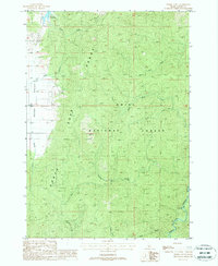
1988 Map of Sixmile Point
USGS Topo · Published 1988About this map
Boise National Forest dominates the high-elevation terrain of this 1980s provisional study, where the landscape is defined by the steep drainage basins of the Middle Fork Payette River and its numerous tributaries. The map details the transition from the flat, open expanse of Round Valley on the western edge to the prominent peak of Sixmile Point. Water management and recreational access are visible through the inclusion of Herrick Reservoir in the north and Rattlesnake Campground near the river’s edge. The complex network of drainages, including Sixmile Creek, Bacon Creek, and the North Fork, illustrates the rugged watershed patterns that have long dictated movement and land use in this part of Valley County.
Find a feature on this map
18 named features on this map. Tap any name to fly to it.
Don’t see what you’re looking for? This feature index may not catch every label — zoom into the map to look around manually.
Map Details
Editions of this 1988 Sixmile Point Map
This is the sole edition of this map. No revisions or reprints were ever made.
Other maps of this area

1894 · Squaw Creek
USGS Topo · 1:125,000

1909 · Garden Valley
USGS Topo · 1:125,000

1953 · Smiths Ferry
USGS Topo · 1:62,500

1953 · Boiling Springs
USGS Topo · 1:62,500

1953 · Banks
USGS Topo · 1:62,500

1955 · Baker
USGS Topo · 1:250,000

1957 · Challis
USGS Topo · 1:250,000

1959 · Baker
USGS Topo · 1:250,000

1959 · Garden Valley
USGS Topo · 1:62,500

1960 · Challis
USGS Topo · 1:250,000