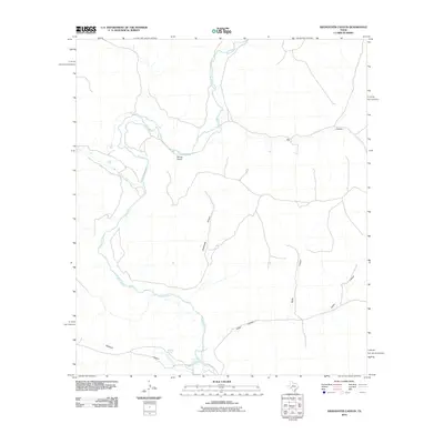
2010 Map of Sixshooter Canyon
USGS Topo · Published 2010About this map
The Pecos River carves a winding path through this western Texas landscape, defining a region where water sources are the primary markers of human and natural activity. Dunlap Ranch stands as a notable point of settlement in this arid environment, situated near the river’s confluence with Independence Creek. The terrain is characterized by a complex network of dry washes and named drainages, including the prominent Sixshooter Canyon and Big Canyon, which illustrate the erosion patterns typical of the Edwards Plateau.
Find a feature on this map
10 named features on this map. Tap any name to fly to it.
Don’t see what you’re looking for? This feature index may not catch every label — zoom into the map to look around manually.
Map Details
Editions of this 2010 Sixshooter Canyon Map
This is the sole edition of this map. No revisions or reprints were ever made.
Other maps of this area

1929 · Sheffield
USGS Topo · 1:125,000

1954 · Sonora
USGS Topo · 1:250,000

1958 · Sonora
USGS Topo · 1:250,000

1967 · Burnt Canyon
USGS Topo · 1:24,000

1967 · Sheffield SE
USGS Topo · 1:24,000

1967 · Dead Man Canyon
USGS Topo · 1:24,000

1970 · Antone Canyon
USGS Topo · 1:24,000
1970 · Prince Albert Draw
USGS Topo · 1:24,000

1973 · Post Canyon
USGS Topo · 1:24,000
1973 · Sixshooter Canyon
USGS Topo · 1:24,000