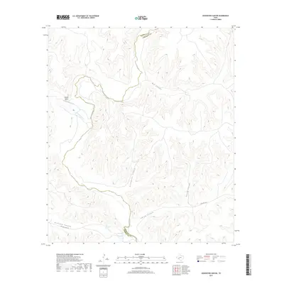
2019 Map of Sixshooter Canyon
USGS Topo · Published 2019About this map
The Pecos River carves a deep path through the West Texas landscape at the boundary between Terrell and Crockett counties. This high-plateau region is defined by a network of drainage systems, most notably Sixshooter Canyon and Big Canyon, which feed toward the river valley. Water sources are critical markers in this arid environment, with Richland Spring, Wolf Spring, and the winding Independence Cr providing essential hydration for the surrounding ranchlands. Human presence is sparse but strategic, evidenced by the Chandler Ranch Airport situated near the river bluffs and a handful of backcountry routes like Richland Springs Rd. The map illustrates the extreme verticality of the Trans-Pecos, where deep incisions like Sulfur Canyon and Indian Canyon reveal the complex topography of the Stockton Plateau.
Find a feature on this map
14 named features on this map. Tap any name to fly to it.
Don’t see what you’re looking for? This feature index may not catch every label — zoom into the map to look around manually.
Map Details
Editions of this 2019 Sixshooter Canyon Map
This is the sole edition of this map. No revisions or reprints were ever made.
Other maps of this area

1929 · Sheffield
USGS Topo · 1:125,000

1954 · Sonora
USGS Topo · 1:250,000

1958 · Sonora
USGS Topo · 1:250,000

1967 · Burnt Canyon
USGS Topo · 1:24,000

1967 · Sheffield SE
USGS Topo · 1:24,000

1967 · Dead Man Canyon
USGS Topo · 1:24,000

1970 · Antone Canyon
USGS Topo · 1:24,000
1970 · Prince Albert Draw
USGS Topo · 1:24,000

1973 · Post Canyon
USGS Topo · 1:24,000
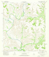
1973 · Sixshooter Canyon
USGS Topo · 1:24,000