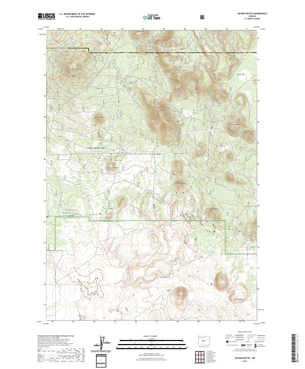
2023 Map of Sixteen Butte
USGS Topo · Published 2023About this map
Sixteen Butte and a cluster of surrounding cinder cones dominate this high-desert landscape along the border of Deschutes and Lake counties. Situated largely within the Deschutes National Forest, the terrain is defined by volcanic features and expansive flats like Coyote Flat. The 2023 survey illustrates the modern intersection of conservation and recreation, where public land management is visible through a network of designated off-highway vehicle routes including the Ohv #40 Tr and Ohv #90 Tr. These trails wind between family-named and descriptively named summits such as Deadlog Butte, Wigtop Butte, and the isolated depression of Little Garden. The map provides a precise look at the township and range survey lines that still govern this sparsely populated part of the Oregon interior.
Find a feature on this map
21 named features on this map. Tap any name to fly to it.
Don’t see what you’re looking for? This feature index may not catch every label — zoom into the map to look around manually.
Map Details
Editions of this 2023 Sixteen Butte Map
This is the sole edition of this map. No revisions or reprints were ever made.
Other maps of this area

1931 · Newberry Crater
USGS Topo · 1:125,000

1935 · Newberry Crater
USGS Topo · 1:125,000

1955 · Crescent
USGS Topo · 1:250,000

1957 · Crescent
USGS Topo · 1:250,000

1958 · Crescent
USGS Topo · 1:250,000

1970 · Crescent
USGS Topo · 1:250,000

1979 · Crescent
USGS Topo · 1:100,000

1981 · Fox Butte
USGS Topo · 1:24,000

1981 · Hogback Butte
USGS Topo · 1:24,000

1981 · Cougar Mtn
USGS Topo · 1:24,000