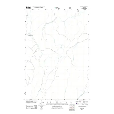
2011 Map of Sixteen
USGS Topo · Published 2011About this map
Sixteenmile Creek and its many tributaries carve through this section of Meagher County, defining a landscape of high ridges and narrow canyon bottoms. The small settlement of Sixteen and the nearby Robertson Ranch are the primary points of habitation, connected by a network of rural routes including Sixteen Mile Rd and Indian Creek Rd. This area is characterized by its high-altitude water management and resource extraction, evidenced by the Two Dollar Bill Dam on Indian Creek and the NW SE Section 30 Mine to the northeast.
Find a feature on this map
20 named features on this map. Tap any name to fly to it.
Don’t see what you’re looking for? This feature index may not catch every label — zoom into the map to look around manually.
Map Details
Editions of this 2011 Sixteen Map
This is the sole edition of this map. No revisions or reprints were ever made.
Other maps of this area

1886 · Fort Logan
USGS Topo · 1:250,000

1886 · Little Belt Mts.
USGS Topo · 1:250,000

1894 · Little Belt Mts.
USGS Topo · 1:250,000

1897 · Little Belt Mts.
USGS Topo · 1:250,000

1898 · Little Belt Mts.
USGS Topo · 1:250,000

1902 · Little Belt Mts.
USGS Topo · 1:250,000

1948 · White Sulphur Springs
USGS Topo · 1:250,000

1948 · Sixteen
USGS Topo · 1:24,000

1949 · Maudlow
USGS Topo · 1:62,500

1951 · Sixteen NE
USGS Topo · 1:24,000