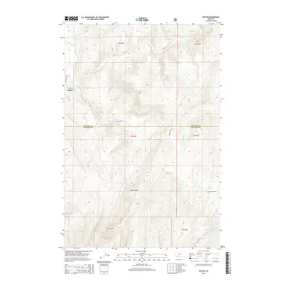
2014 Map of Sixteen
USGS Topo · Published 2014About this map
Sixteen serves as the primary point of settlement within this landscape where the high plains meet the mountain foothills. The topography is defined by the massive Elkhorn Ridge and the intricate drainage network of Sixteenmile Cr, which draws in numerous tributaries including Rye Grass Cr and Battle Cr. This 2014 survey documents the remote boundary between Meagher County and Gallatin County, a line that cuts through high elevations and across the valleys of Indian Cr and Meadow Cr. The road network remains sparse, centered on routes like Sixteen Mile Rd and Meadow Creek Rd, reflecting the ranching and mountainous character of the Big Belt Mountains region. The map provides a clear look at the public land survey system grid, showing the township and range divisions that have historically managed this Montana backcountry.
Find a feature on this map
21 named features on this map. Tap any name to fly to it.
Don’t see what you’re looking for? This feature index may not catch every label — zoom into the map to look around manually.
Map Details
Editions of this 2014 Sixteen Map
This is the sole edition of this map. No revisions or reprints were ever made.
Other maps of this area

1886 · Fort Logan
USGS Topo · 1:250,000

1886 · Little Belt Mts.
USGS Topo · 1:250,000

1894 · Little Belt Mts.
USGS Topo · 1:250,000

1897 · Little Belt Mts.
USGS Topo · 1:250,000

1898 · Little Belt Mts.
USGS Topo · 1:250,000

1902 · Little Belt Mts.
USGS Topo · 1:250,000

1948 · White Sulphur Springs
USGS Topo · 1:250,000

1948 · Sixteen
USGS Topo · 1:24,000

1949 · Maudlow
USGS Topo · 1:62,500

1951 · Sixteen NE
USGS Topo · 1:24,000