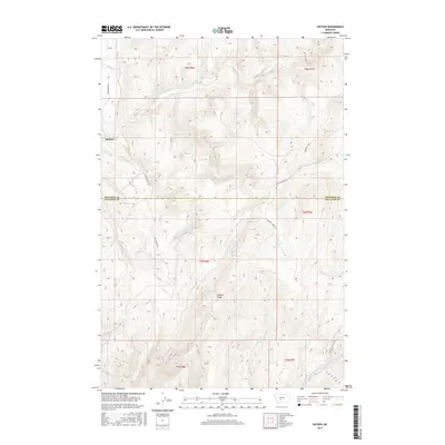
2017 Map of Sixteen
USGS Topo · Published 2017About this map
Sixteen lies at the northern edge of this high-elevation landscape, situated where Sixteenmile Cr flows westward through the mountain drainages. The area is defined by the significant topographic rise of Elkhorn Ridge, which serves as a central landmark between the various creek systems. A network of primitive roads follows the natural contours of the land, including Sixteen Mile Rd and Indian Creek Rd, tracing routes through the remote Meagher and Gallatin County line. Numerous watercourses like Indian Cr, Meadow Cr, and the Middle Fork Sixteenmile Cr carve through the terrain, illustrating the complex drainage patterns of this Big Belt Mountains region. The map reflects a modern era of land management, documenting the intersections of township and range lines across this sparsely populated section of Montana.
Find a feature on this map
22 named features on this map. Tap any name to fly to it.
Don’t see what you’re looking for? This feature index may not catch every label — zoom into the map to look around manually.
Map Details
Editions of this 2017 Sixteen Map
This is the sole edition of this map. No revisions or reprints were ever made.
Other maps of this area

1886 · Fort Logan
USGS Topo · 1:250,000

1886 · Little Belt Mts.
USGS Topo · 1:250,000

1894 · Little Belt Mts.
USGS Topo · 1:250,000

1897 · Little Belt Mts.
USGS Topo · 1:250,000

1898 · Little Belt Mts.
USGS Topo · 1:250,000

1902 · Little Belt Mts.
USGS Topo · 1:250,000

1948 · White Sulphur Springs
USGS Topo · 1:250,000

1948 · Sixteen
USGS Topo · 1:24,000

1949 · Maudlow
USGS Topo · 1:62,500

1951 · Sixteen NE
USGS Topo · 1:24,000