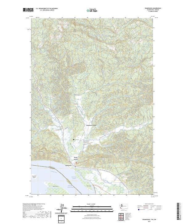
2023 Map of Skamokawa
USGS Topo · Published 2023About this map
Skamokawa sits at the junction of several valley systems where they meet the expansive Columbia River shoreline. This landscape is defined by the transition from the high elevations of the Grays River Divide down into the productive bottomlands of East Valley, Middle Valley, and West Valley. The map documents a complex network of waterways, including Steamboat Slough and Brooks Slough, which weave around riverine landmarks like Price Island and Welch Island. Protected lands are a major feature of the riverfront, notably the Julia Butler Hansen Refuge for the Columbian White-Tailed Deer. Local history and genealogy interests are centered around the Fern Hill Cem and the settlement at Sleepy Hollow, while the Skamokawa East Valley Airport serves as a modern waypoint in this river-oriented community.
Find a feature on this map
61 named features on this map. Tap any name to fly to it.
Don’t see what you’re looking for? This feature index may not catch every label — zoom into the map to look around manually.
Map Details
Editions of this 2023 Skamokawa Map
This is the sole edition of this map. No revisions or reprints were ever made.
Other maps of this area

1940 · Svensen
USGS Topo · 1:62,500

1940 · Brookfield
USGS Topo · 1:62,500

1941 · Skamokawa
USGS Topo · 1:62,500

1941 · Cathlamet
USGS Topo · 1:62,500

1953 · Hoquiam
USGS Topo · 1:250,000

1953 · Skamokawa
USGS Topo · 1:62,500

1953 · Cathlamet
USGS Topo · 1:62,500
1955 · Svensen
USGS Topo · 1:62,500

1955 · Grays River
USGS Topo · 1:62,500

1957 · Hoquiam
USGS Topo · 1:250,000