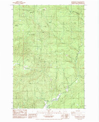
1985 Map of Skamokawa Pass
USGS Topo · Published 1985About this map
The hills of Wahkiakum County rise sharply above the southern drainage of the Columbia River in this mid-1980s landscape. McDonald stands as the primary named point of reference in an area defined by heavy timber activity and winding watercourses. The network of forest roads and ridgelines, such as Huckleberry Ridge, illustrates the industrial importance of the region's high ground and the complexities of navigating the Pacific Northwest's coastal range. The terrain is deeply carved by numerous creeks that feed into larger local river systems, showing the natural boundaries that shaped early settlement patterns and logging operations in this corner of Washington.
Find a feature on this map
1 named feature on this map. Tap any name to fly to it.
Don’t see what you’re looking for? This feature index may not catch every label — zoom into the map to look around manually.
Map Details
Editions of this 1985 Skamokawa Pass Map
This is the sole edition of this map. No revisions or reprints were ever made.
Other maps of this area

1919 · Mayger
USGS Topo · 1:62,500

1941 · Skamokawa
USGS Topo · 1:62,500

1941 · Clatskanie
USGS Topo · 1:62,500

1941 · Cathlamet
USGS Topo · 1:62,500

1952 · Clatskanie
USGS Topo · 1:62,500

1953 · Hoquiam
USGS Topo · 1:250,000

1953 · Ryderwood
USGS Topo · 1:62,500

1953 · Skamokawa
USGS Topo · 1:62,500

1953 · Cathlamet
USGS Topo · 1:62,500

1957 · Hoquiam
USGS Topo · 1:250,000