
1953 Map of Cathlamet
USGS Topo · Published 1955About this map
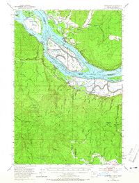
The Columbia River dominates this mid-century landscape, weaving through a complex network of sloughs and alluvial islands such as Tenasillahe Island and Puget Island. On the Washington bank, the town of Cathlamet serves as a hub near the Elochoman River, while the Oregon side features industrial and timber-related settlements like Wauna, Bradwood, and Westport. The Spokane Portland and Seattle railroad follows the southern shoreline, connecting riverside communities and supporting the region's shipping economy. Higher elevations rise sharply away from the water, marked by Nicolai Mtn and Clatskanie Mtn. A distinctive pattern of navigation aids, including the Driscoll Range and Wauna Range, highlights the importance of the river as a commercial artery. Numerous family and local historical markers appear throughout the map, from Greenwood Cem to smaller homestead-era locations like Oklahoma Hill and Taylorville.
Find a feature on this map
87 named features on this map. Tap any name to fly to it.
Don’t see what you’re looking for? This feature index may not catch every label — zoom into the map to look around manually.
Map Details
Editions of this 1953 Cathlamet Map
4 editions found
Other maps of this area

1919 · Mayger
USGS Topo · 1:62,500

1939 · Saddle Mountain
USGS Topo · 1:62,500

1940 · Svensen
USGS Topo · 1:62,500

1940 · Brookfield
USGS Topo · 1:62,500

1940 · Vernonia
USGS Topo · 1:62,500

1941 · Keasey
USGS Topo · 1:62,500

1941 · Skamokawa
USGS Topo · 1:62,500

1941 · Clatskanie
USGS Topo · 1:62,500

1941 · Cathlamet
USGS Topo · 1:62,500

1943 · Vernonia
USGS Topo · 1:62,500