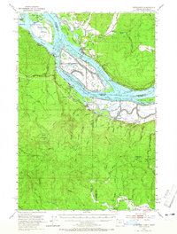
1953 Map of Cathlamet
USGS Topo · Published 1965About this map
The Columbia River dominates this mid-century landscape, carving a complex network of sloughs and islands between Oregon and Washington. The town of Cathlamet sits prominently along the northern bank, connected to the massive landform of Little Island and the intricate channels of Bernie Slough and Welcome Slough. On the Oregon side, the river's edge is defined by industrial and agricultural activity, with the Spokane Portland and Seattle railroad corridor passing through Westport and Wauna.
Find a feature on this map
85 named features on this map. Tap any name to fly to it.
Don’t see what you’re looking for? This feature index may not catch every label — zoom into the map to look around manually.
Map Details
Editions of this 1953 Cathlamet Map
4 editions found

Other maps of this area

1919 · Mayger
USGS Topo · 1:62,500

1939 · Saddle Mountain
USGS Topo · 1:62,500

1940 · Svensen
USGS Topo · 1:62,500

1940 · Brookfield
USGS Topo · 1:62,500

1940 · Vernonia
USGS Topo · 1:62,500

1941 · Keasey
USGS Topo · 1:62,500

1941 · Skamokawa
USGS Topo · 1:62,500

1941 · Clatskanie
USGS Topo · 1:62,500

1941 · Cathlamet
USGS Topo · 1:62,500

1943 · Vernonia
USGS Topo · 1:62,500