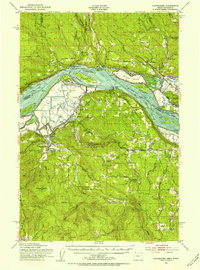
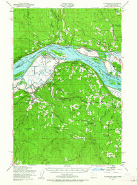
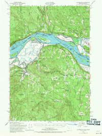
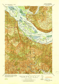
1952 Map of Clatskanie
USGS Topo · Published 1954About this map
The Columbia River forms the central artery of this 1952 study, where the state boundary between Washington and Oregon weaves through a complex network of islands and channels. Land use at this mid-century moment is defined by the industrial and transport infrastructure of the lower Columbia, including the Spokane Portland and Seattle railroad and numerous levees and dikes protecting low-lying tracts like Crims Island and Willow Grove.
Find a feature on this map
107 named features on this map. Tap any name to fly to it.
Don’t see what you’re looking for? This feature index may not catch every label — zoom into the map to look around manually.
Map Details
Editions of this 1952 Clatskanie Map
3 editions found
Other maps of this area

1919 · Mayger
USGS Topo · 1:62,500

1921 · Kalama
USGS Topo · 1:62,500

1922 · St. Helens
USGS Topo · 1:62,500

1940 · Vernonia
USGS Topo · 1:62,500

1941 · Keasey
USGS Topo · 1:62,500

1941 · St Helens
USGS Topo · 1:62,500

1941 · Olequa
USGS Topo · 1:62,500

1941 · Skamokawa
USGS Topo · 1:62,500

1941 · Clatskanie
USGS Topo · 1:62,500
1941 · Cathlamet
USGS Topo · 1:62,500