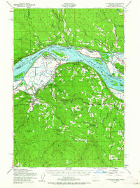
1952 Map of Clatskanie
USGS Topo · Published 1963About this map
The Columbia River serves as the dominant artery of this 1952 landscape, its channels and sloughs like Fisher Island Slough and Bradbury Slough shaping the river-and-rail economy of the mid-century. Industry and transit are closely linked along the banks where the Spokane Portland and Seattle RR parallels the water, connecting settlements such as Mayger, Locoda, and Willow Grove. Inland, the terrain rises toward the Clatskanie Heights, revealing a network of smaller agricultural and timber communities including Quincy, Delena, and Mist. Genealogists will find significant value in the distribution of rural institutions, from the Murray Hill Cem and Bryant Cemetery near Clatskanie to several neighborhood schoolhouses like Cedar Grove Sch and Lost Creek Sch. The map also captures infrastructure such as the Benson Lookout and various Rock Quarry sites, reflecting the region's active land management and resource extraction.
Find a feature on this map
90 named features on this map. Tap any name to fly to it.
Don’t see what you’re looking for? This feature index may not catch every label — zoom into the map to look around manually.
Map Details
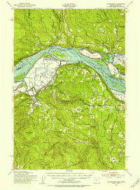
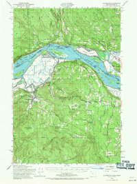
Editions of this 1952 Clatskanie Map
3 editions found
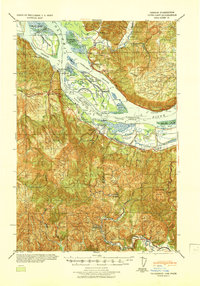
Other maps of this area

1919 · Mayger
USGS Topo · 1:62,500

1921 · Kalama
USGS Topo · 1:62,500

1922 · St. Helens
USGS Topo · 1:62,500

1940 · Vernonia
USGS Topo · 1:62,500

1941 · Keasey
USGS Topo · 1:62,500

1941 · St Helens
USGS Topo · 1:62,500

1941 · Olequa
USGS Topo · 1:62,500

1941 · Skamokawa
USGS Topo · 1:62,500

1941 · Clatskanie
USGS Topo · 1:62,500
1941 · Cathlamet
USGS Topo · 1:62,500